- Home
- :
- All Communities
- :
- Products
- :
- ArcMap (Retired)
- :
- ArcMap Questions
- :
- How can I make climate envelopes?
- Subscribe to RSS Feed
- Mark Topic as New
- Mark Topic as Read
- Float this Topic for Current User
- Bookmark
- Subscribe
- Mute
- Printer Friendly Page
How can I make climate envelopes?
- Mark as New
- Bookmark
- Subscribe
- Mute
- Subscribe to RSS Feed
- Permalink
I try to create climatic envelopes of tree species in ArcGIS like Christian Kölling here: https://www.lwf.bayern.de/mam/cms04/boden-klima/dateien/afz-klimahuellen-fuer-27-baumarten.pdf
For this I have climate data as raster format and tree data as raster format. I have already converted the tree data into shapefile and blended it with the climate data set, so that my result is now: Where the trees are, I have the temperature in one layer (grid) and the precipitation in one layer (grid). How can I go on now? I would have to represent the data as in a scatter plot with points, only as an area. And then, if possible, calculate different percentiles.
Since I'm not very familiar with ArcGIS, I don't know how to do this. Can anybody help me further?
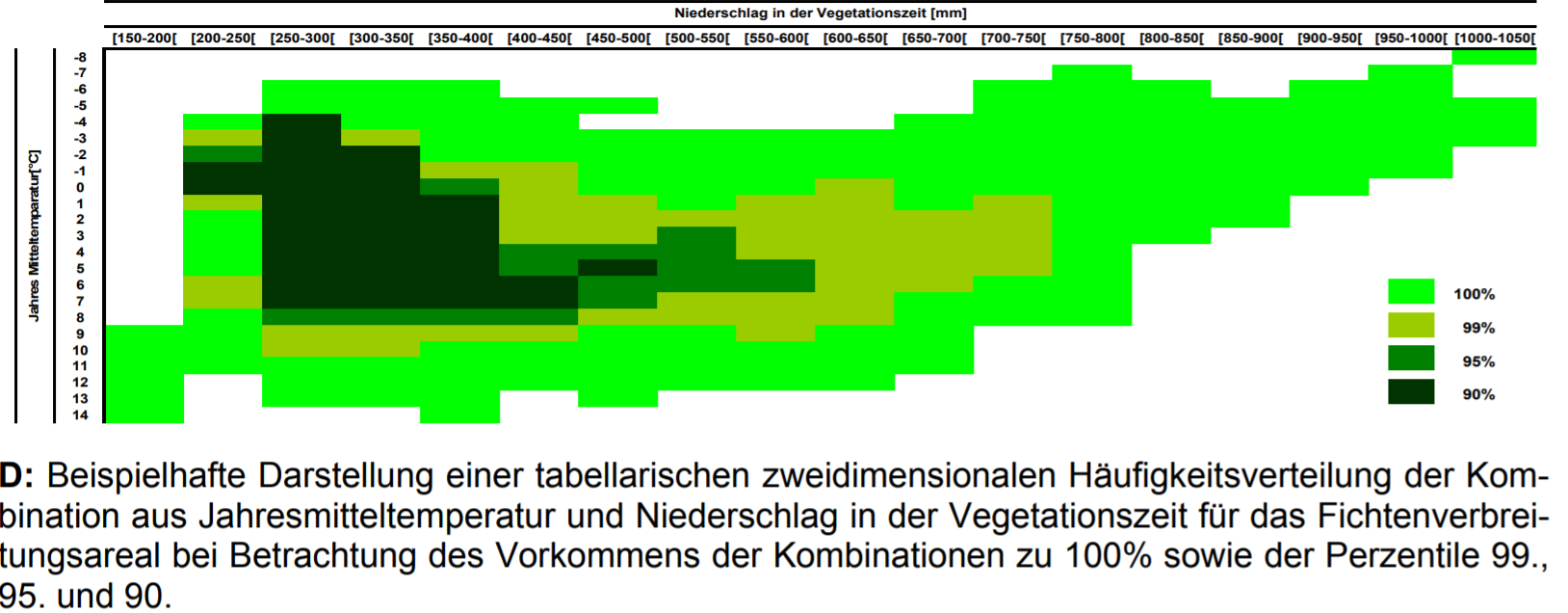
Example Climate envelope and percentils:
Example how Christian Köllings climate envelopes looks like:
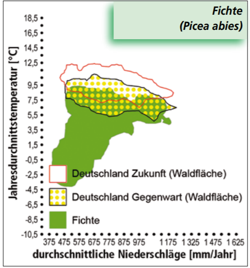
Green: The climate envelope of Picea abies in Europe. Yellow dottet: climate of the Picea Abies habitat in Germany today. Red: climate of the Picea Abies habitat in future.