- Home
- :
- All Communities
- :
- Products
- :
- ArcGIS Web AppBuilder
- :
- ArcGIS Web AppBuilder Questions
- :
- Symbology Scaling and Layer List
- Subscribe to RSS Feed
- Mark Topic as New
- Mark Topic as Read
- Float this Topic for Current User
- Bookmark
- Subscribe
- Mute
- Printer Friendly Page
Symbology Scaling and Layer List
- Mark as New
- Bookmark
- Subscribe
- Mute
- Subscribe to RSS Feed
- Permalink
I have tried creating map services by caching and setting a reference scale but the best way I have found to do this is to create a group layer and set scale ranges in ArcMap and then publish the service. the only problem is that you have to expand the layer list four times to see the symbols and all layers are listed. Maybe there is a better way? or a way to customize the layer list widget?
- Mark as New
- Bookmark
- Subscribe
- Mute
- Subscribe to RSS Feed
- Permalink
Amy,
The only way I can think of getting around that is to hide the layer that are not visible due to scale in the layerlist widget. You know the enhancement I provided to grayout the layer title when out of scale instead some code could be added to set the css display:none; instead.
- Mark as New
- Bookmark
- Subscribe
- Mute
- Subscribe to RSS Feed
- Permalink
Me too, I posted on Esri Ideas.
- Mark as New
- Bookmark
- Subscribe
- Mute
- Subscribe to RSS Feed
- Permalink
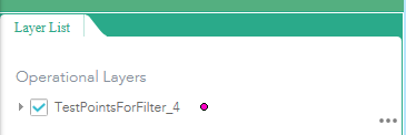
This is what i really want. symbol next to service layer name or points if multiple layers in one service.
Before

After
- Mark as New
- Bookmark
- Subscribe
- Mute
- Subscribe to RSS Feed
- Permalink
Amy,
I am sure that could be done but that is a bit more than I am willing to help with.