Turn on suggestions
Auto-suggest helps you quickly narrow down your search results by suggesting possible matches as you type.
Cancel
- Home
- :
- All Communities
- :
- Products
- :
- ArcGIS Spatial Analyst
- :
- ArcGIS Spatial Analyst Questions
- :
- Zonal Statistic As Table--Problem calculating MEAN...
Options
- Subscribe to RSS Feed
- Mark Topic as New
- Mark Topic as Read
- Float this Topic for Current User
- Bookmark
- Subscribe
- Mute
- Printer Friendly Page
Zonal Statistic As Table--Problem calculating MEAN-Values
Subscribe
10063
10
03-05-2012 09:35 PM
by
Anonymous User
Not applicable
03-05-2012
09:35 PM
- Mark as New
- Bookmark
- Subscribe
- Mute
- Subscribe to RSS Feed
- Permalink
Original User: patflo
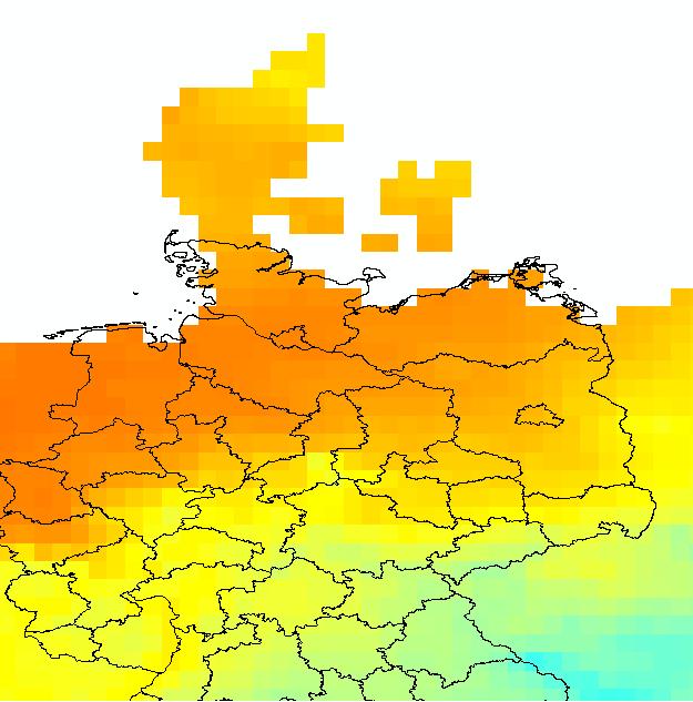
Hello i`ve got a problem doing the zonal statistic calculation with a layer and a shape-file. My layer is a temperature layer for europe and my shapefile is a polygon shapefile from Germany. When i want to do the MEAN calculation for every polygon in the shapefile it gives me MEAN-Values for the temperature of -1100 degrees. I think the problem is that some of the polygons are not fully covered by the raster layer? Has someone an idea how to get the correct values?
in the attachement i put a pic of the shapefile with the raster layer and the table.
Thanks in advance for your help
10 Replies
03-08-2012
10:49 PM
- Mark as New
- Bookmark
- Subscribe
- Mute
- Subscribe to RSS Feed
- Permalink
UPDATE: I tried to do the same task in the ArcGis 9.3 Version and it worked correct. There are no values with -1170 in the zonal statistics table so i think this is a bug in the Arcgis10 Version.
- « Previous
-
- 1
- 2
- Next »
- « Previous
-
- 1
- 2
- Next »