- Home
- :
- All Communities
- :
- Products
- :
- ArcGIS Spatial Analyst
- :
- ArcGIS Spatial Analyst Questions
- :
- Tabulate Area 2 Tool returning odd results
- Subscribe to RSS Feed
- Mark Topic as New
- Mark Topic as Read
- Float this Topic for Current User
- Bookmark
- Subscribe
- Mute
- Printer Friendly Page
Tabulate Area 2 Tool returning odd results
- Mark as New
- Bookmark
- Subscribe
- Mute
- Subscribe to RSS Feed
- Permalink
I am having trouble with the output of the "Tabulate Area 2" tool from the spatial analyst supplemental toolbox:
http://blogs.esri.com/esri/arcgis/2013/11/26/new-spatial-analyst-supplemental-tools-v1-3/
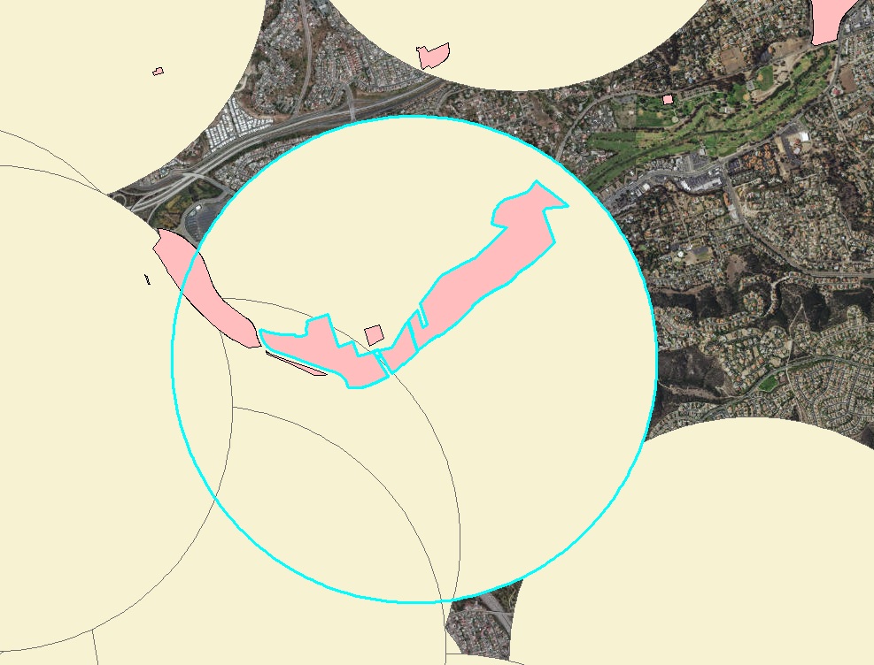
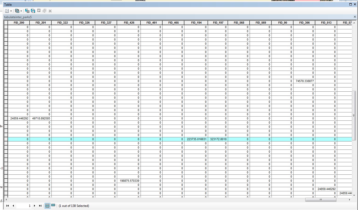
I have a layer of overlapping buffers (polygon) as the zones and then a layer of parks where I'm trying to find the area of parks (also polygon) that intersect with each individual buffer. The parks layer does not have any overlap. The tabulate area 2 tool seems like it should be exactly what I want. However, the area of intersection it's returning is not what it should be and I have no idea why. I've gone ahead and projected both files so they're the same and in meters, and I've also converted one of my buffer polygon files from a multi-part to a single-part. The numbers are off by thousands of meters and do not even appear to be representing a size of any unit seeing as 3 of the numbers repeat (in the example below). Does anyone have any ideas about what's going on here?
The highlighted FIDs at the top should have values of a portion of 207847 (since not all of it falls into the buffer) and 366887 meters, respectively.