Create Draft Footprint Raster Tool failed with below error message.
This tool is provided within 3D basemap solution.
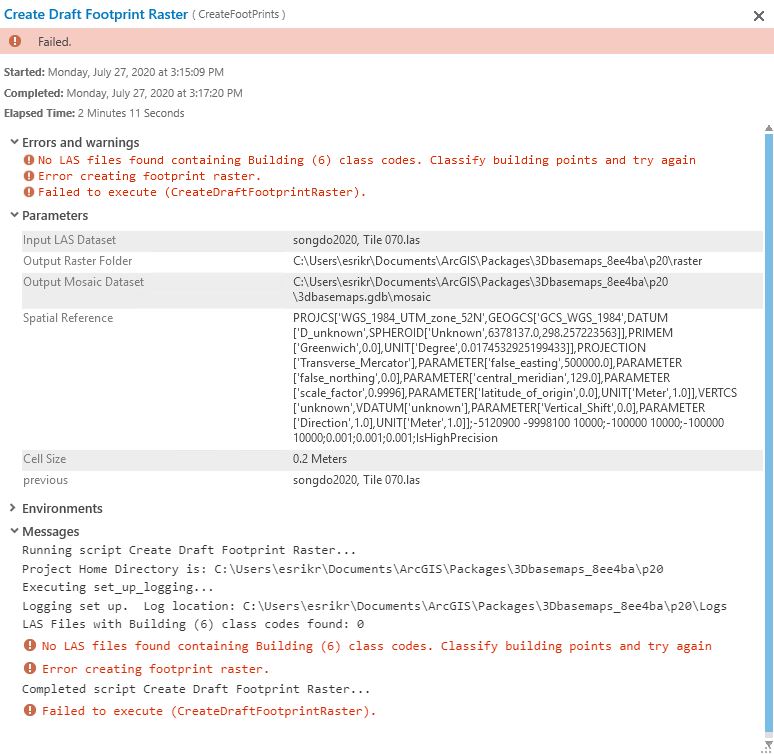
Above messages said the LAS file has no Building class code.
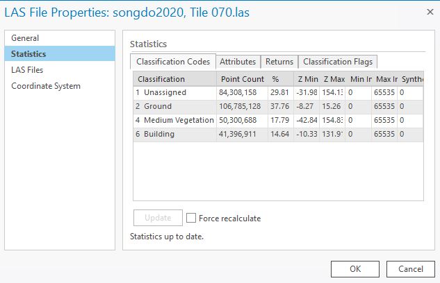
But the input LAS data the client uses has Building Class.
Below image is properties of the input LAS data.
Dose anyone know why this tool failed?