Turn on suggestions
Auto-suggest helps you quickly narrow down your search results by suggesting possible matches as you type.
Cancel
- Home
- :
- All Communities
- :
- Developers
- :
- Native Maps SDKs
- :
- Runtime SDK for Android Questions
- :
- Odd Issue with GraphicsLayer::getGraphicIDs(float ...
Options
- Subscribe to RSS Feed
- Mark Topic as New
- Mark Topic as Read
- Float this Topic for Current User
- Bookmark
- Subscribe
- Mute
- Printer Friendly Page
Odd Issue with GraphicsLayer::getGraphicIDs(float x, float y, int tolerance)
Subscribe
1852
0
05-23-2013 06:23 AM
05-23-2013
06:23 AM
- Mark as New
- Bookmark
- Subscribe
- Mute
- Subscribe to RSS Feed
- Permalink
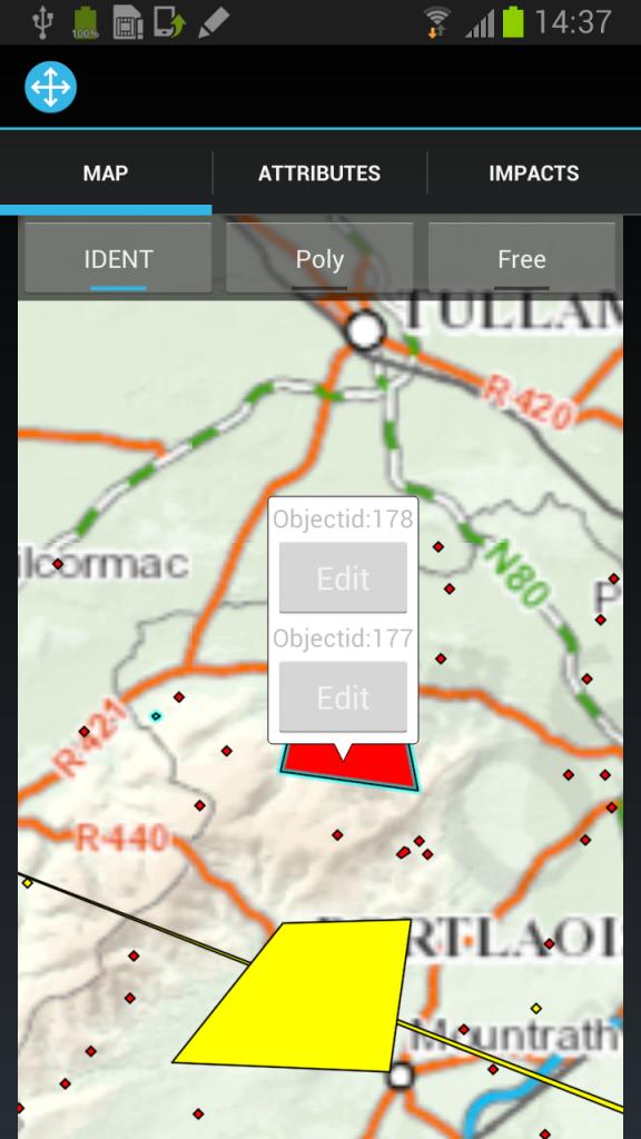
Implementing a typical identify - and doing the following- on a ArcGISFeatureLayer with 50 or so polygons - the GetGraphicsID() frequently brings back more polygons than expected - polygons that are not connected and not near the point selected:
Notes:
* The polygons brought back have different objectids
* There are other polygons between and nearer that are not brought back as the result (see the selected items in the screenshot)
* it doesn't happen with all polygons -
* once you find two polygons like this - it is reproducible - clicking on either one will select the other even if they are at opposite ends of the map.
Create Layer code and add polygons section of code
Options options = new Options();
options.mode = MODE.SNAPSHOT;
FeatureSet fs = new FeatureSet();
fLayer = new ArcGISFeatureLayer(CachedData.sRestLayerDef, fs, options);
Graphic[] graphics=(Graphic[])(msg.obj);
{//all graphics are created and added one at a time
Polygon geom = Utils.GetPolygonFromJson(...);
Graphic graphic = new Graphic(geom, fill, attributes, null);;
graphics.add(graphic);
}
fLayer.addGraphics(graphics);
@Override public boolean onSingleTap(final MotionEvent e)
{
...
int[] ids = featureLayer.getGraphicIDs((float)e.getX(), (float)e.getY(), 15);
featureLayer.setSelectedGraphics(ids, true);
}
[ATTACH=CONFIG]24614[/ATTACH]
Thanks...
Ambrose.
0 Replies