Turn on suggestions
Auto-suggest helps you quickly narrow down your search results by suggesting possible matches as you type.
Cancel
- Home
- :
- All Communities
- :
- Products
- :
- ArcGIS Pro
- :
- ArcGIS Pro Questions
- :
- Projection problem when adding HDF5 file as multid...
Options
- Subscribe to RSS Feed
- Mark Topic as New
- Mark Topic as Read
- Float this Topic for Current User
- Bookmark
- Subscribe
- Mute
- Printer Friendly Page
Projection problem when adding HDF5 file as multidimensional raster layer
Subscribe
1489
1
11-16-2018 09:35 AM
11-16-2018
09:35 AM
- Mark as New
- Bookmark
- Subscribe
- Mute
- Subscribe to RSS Feed
- Permalink
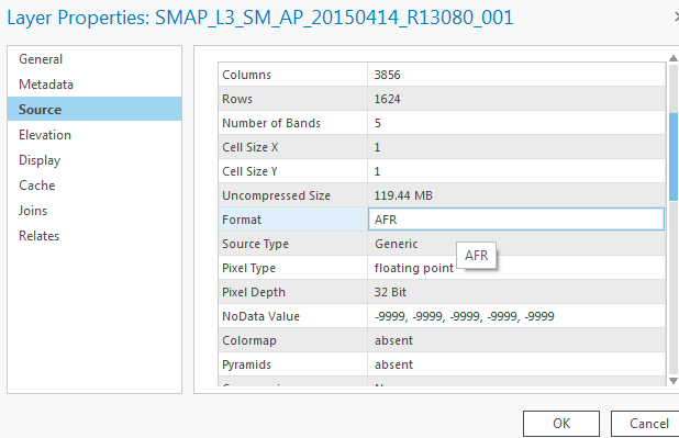
I think the problem was generated by the incorrect cell size, which should be read from the HDF5 file attributes. Anyone has a good idea of how to correct this issue?
1 Reply
11-16-2018
02:46 PM
- Mark as New
- Bookmark
- Subscribe
- Mute
- Subscribe to RSS Feed
- Permalink
according to
Multidimensional raster types—ArcGIS Pro | ArcGIS Desktop
non raster data is ignored... but it isn't clear whether that includes coordinates and/or cell sizes... so it guesses at a cell size, which is probably just a reflection of rows and columns (assuming continuity in space and it doesn't represent sparse data).
I suspect you have to troll the remainder of the data to find out more information to use it as a 'map'