- Home
- :
- All Communities
- :
- Products
- :
- ArcGIS Pro
- :
- ArcGIS Pro Questions
- :
- Profile graph with own DEM data
- Subscribe to RSS Feed
- Mark Topic as New
- Mark Topic as Read
- Float this Topic for Current User
- Bookmark
- Subscribe
- Mute
- Printer Friendly Page
Profile graph with own DEM data
- Mark as New
- Bookmark
- Subscribe
- Mute
- Subscribe to RSS Feed
- Permalink
How can I use the profile graph tool with my own .GeoTiffs? The elevation profile seems to derive elevation along a specified line using some background online very coarse resolution GEBCO DEM (bathymetry). I have a high-resolution GeoTiff for the area and I can't see any option to specify from which raster to extract the elevation values.
PS I can't believe how difficult the implementation of some basic tools is in ArcGIS Pro is in comparison to ArcMap or QGIS.
- Mark as New
- Bookmark
- Subscribe
- Mute
- Subscribe to RSS Feed
- Permalink
image of your issue?
properties of the geotiff?
are you using Profile graph—ArcGIS Pro | Documentation
or some other means to extract the data? (there are several)
... sort of retired...
- Mark as New
- Bookmark
- Subscribe
- Mute
- Subscribe to RSS Feed
- Permalink
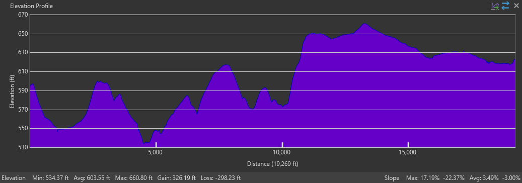
Have you found a solution to this issue? Please let me know what your workflow is. I'm very disappointed in Esri's options in "Pro". I can do an Elevation Profile by setting the DEM as my ground surface in a Local Scene, but this only seems to do one line at a time (even when multiple are selected) and the options for manipulating the profile appearance are. . .well, there are none. You get what you get. Hope you like purple! The canned Profile Graph tool gives you more control over the graph appearance but no control over the surface. If it were anywhere even in the ballpark of what my actual elevations are, I'd use it, but it is garbage. My elevation range should be about 550-650ft but when I change the units to FEET in the Profile Graph, it's showing around 165-200ft. This makes NO sense to me and every time I need to do this task for someone, I find myself searching and not coming up with any real solutions. I guess I'll see what I can do in QGIS. This should be VERY easy. Please let me know if there's something hidden right in front of my face.
- Mark as New
- Bookmark
- Subscribe
- Mute
- Subscribe to RSS Feed
- Permalink
Right click on the raster in the contents pane/create chart/surface profile. Try this - I have been using it for quite some time and it's fit for purpose.