- Home
- :
- All Communities
- :
- Products
- :
- ArcGIS Pro
- :
- ArcGIS Pro Questions
- :
- problem using add field into my attribute table
- Subscribe to RSS Feed
- Mark Topic as New
- Mark Topic as Read
- Float this Topic for Current User
- Bookmark
- Subscribe
- Mute
- Printer Friendly Page
problem using add field into my attribute table
- Mark as New
- Bookmark
- Subscribe
- Mute
- Subscribe to RSS Feed
- Permalink
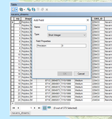
Hello, I am new using ArcMap, I am trying to add a field into my attribute table, and every time I tried to add field properties it does not allow me to do anything. I do not see the Alias, allow null values or default values, the only thing listed is precision and nothing else. please, could you tell me how to modify this? I am using ArcMap 10.4
- Mark as New
- Bookmark
- Subscribe
- Mute
- Subscribe to RSS Feed
- Permalink
a shapefile's table? there is no nullable option. geodatabase featureclasses support that property and more
- Mark as New
- Bookmark
- Subscribe
- Mute
- Subscribe to RSS Feed
- Permalink
Thanks for replying Dan.
I am taking this online class, and I am supposed to see this:
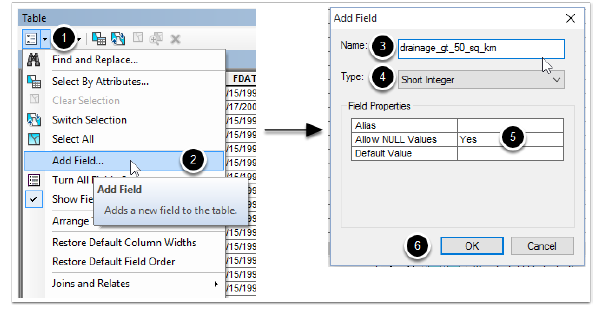
As you see under field properties there are three options listed, as in my case I only see one (precision), what I am trying to find is how to modify this, for me to see the same options.
Thank you
- Mark as New
- Bookmark
- Subscribe
- Mute
- Subscribe to RSS Feed
- Permalink
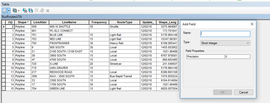
To follow up on Dan's comment, be sure you are adding the field to a Feature Class and not a Shapefile. See my screen shots below. The top one is the attribute table of a Shapefile, while the lower one is the attribute table of a Feature Class in a file geodatabse. They are the exact same data, but in different formats. Notice in the the Shapefile the unique ID field is called FID, where as the Feature Class calls it OBJECTID.

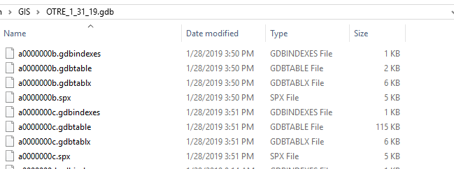
A Shapefile is actually stored on disc as series of inter-related files:

A file geodatabase is actually a 'special' directory on disc, and all the files that make up a feature class make no sense to us humans:
Boat loads of people use the terms Shapefile and Feature Class interchangeably, which is a pet peeve of mine....
- Mark as New
- Bookmark
- Subscribe
- Mute
- Subscribe to RSS Feed
- Permalink
Joe, Thank you! that explains everything! thanks for your time.