- Home
- :
- All Communities
- :
- Products
- :
- ArcGIS Pro
- :
- ArcGIS Pro Questions
- :
- Ortho mapping ArcGIS Pro- successful processing dr...
- Subscribe to RSS Feed
- Mark Topic as New
- Mark Topic as Read
- Float this Topic for Current User
- Bookmark
- Subscribe
- Mute
- Printer Friendly Page
Ortho mapping ArcGIS Pro- successful processing drone images but images not stitching properly
- Mark as New
- Bookmark
- Subscribe
- Mute
- Subscribe to RSS Feed
- Permalink
I'm using ArcGIS Pro 3.0.2
I fly a DJI Mavic Air 2 with an iphone 11, I use Dronelink as the drone mapping app, and I'm working on a Dell laptop.
I teach geography at a university and I wanted to show students how to process drone images and make an orthomosaic on ArcGIS Pro. Back in the spring I flew a "mapping mission" and then easily processed the images by following the ortho mapping directions on ESRI as well as following a video I watched. All 30 students were able to do the same. The orthomosaic finished with no errors and it looked good enough for our purposes.
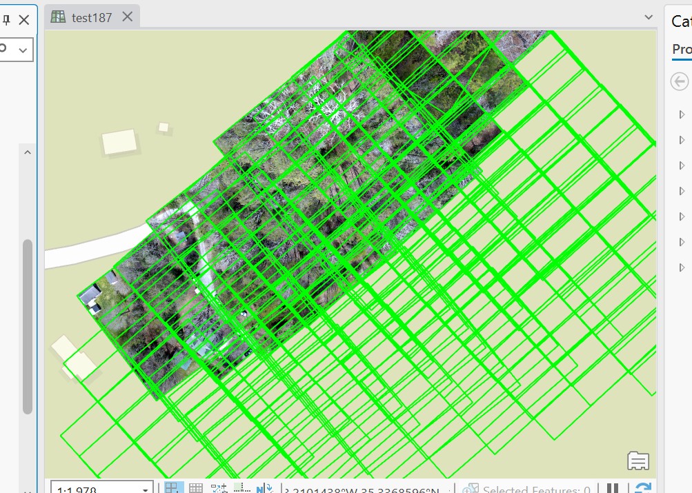
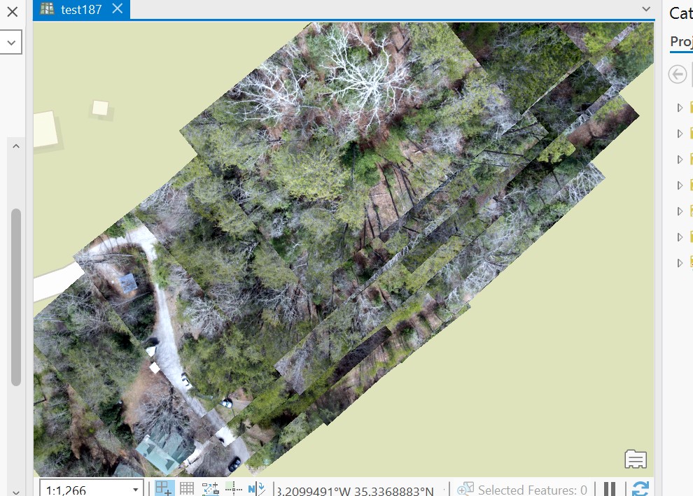
This semester I want to do it again, but the images I attached are the result. The processing finishes with no errors, the center points of the images are in the right location, and you can also see the outline of the images are located in the right place- But the stitching of the images is off to the northwest corner.
I've searched help forums, watched videos, even posted on fb groups on the subject and can't figure this out. I've had a couple of friends able to stitch the images on WebODM and Agisoft and had no problems.
What am I doing wrong now that I didn't do back in the spring?
- Mark as New
- Bookmark
- Subscribe
- Mute
- Subscribe to RSS Feed
- Permalink
Have you been able to find a solution? I'm having the same issue and can't seem to find any info on how to fix it.