Hello,
I noticed there is quite a big difference between these two approaches for segmenting a raster file:
1. Under Imagery tab, Classification tools, Segmentation. Result:
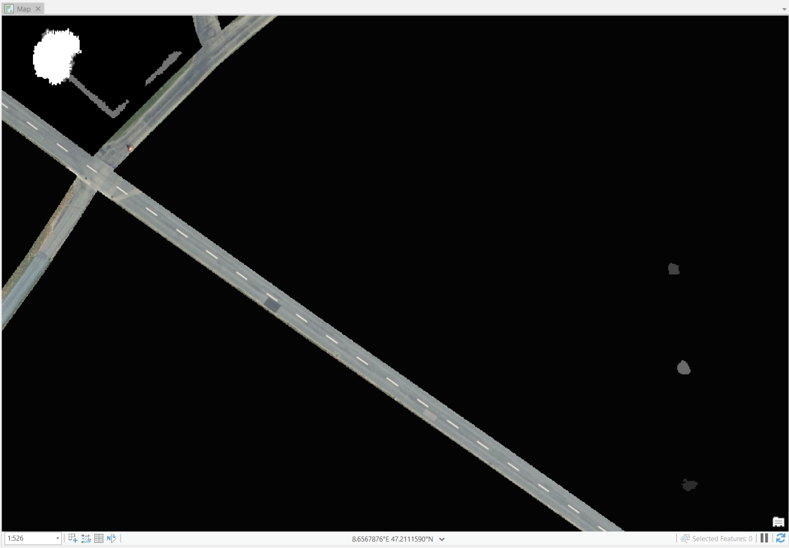
2. Via the geoprocessing tool Segment Mean Shift & the exact same settings, same stretch type. Result:

Whats the difference of these tools? They have very similar input parameters... Is there a way to access the imagery segmentation tool as geoprocessing tool, so that it could be integratet into modelbuilder?
Many thx 