- Home
- :
- All Communities
- :
- Products
- :
- ArcGIS Pro
- :
- ArcGIS Pro Questions
- :
- How do I solve this error: Service layer has a dif...
- Subscribe to RSS Feed
- Mark Topic as New
- Mark Topic as Read
- Float this Topic for Current User
- Bookmark
- Subscribe
- Mute
- Printer Friendly Page
How do I solve this error: Service layer has a different projection than the map's projection
- Mark as New
- Bookmark
- Subscribe
- Mute
- Subscribe to RSS Feed
- Permalink
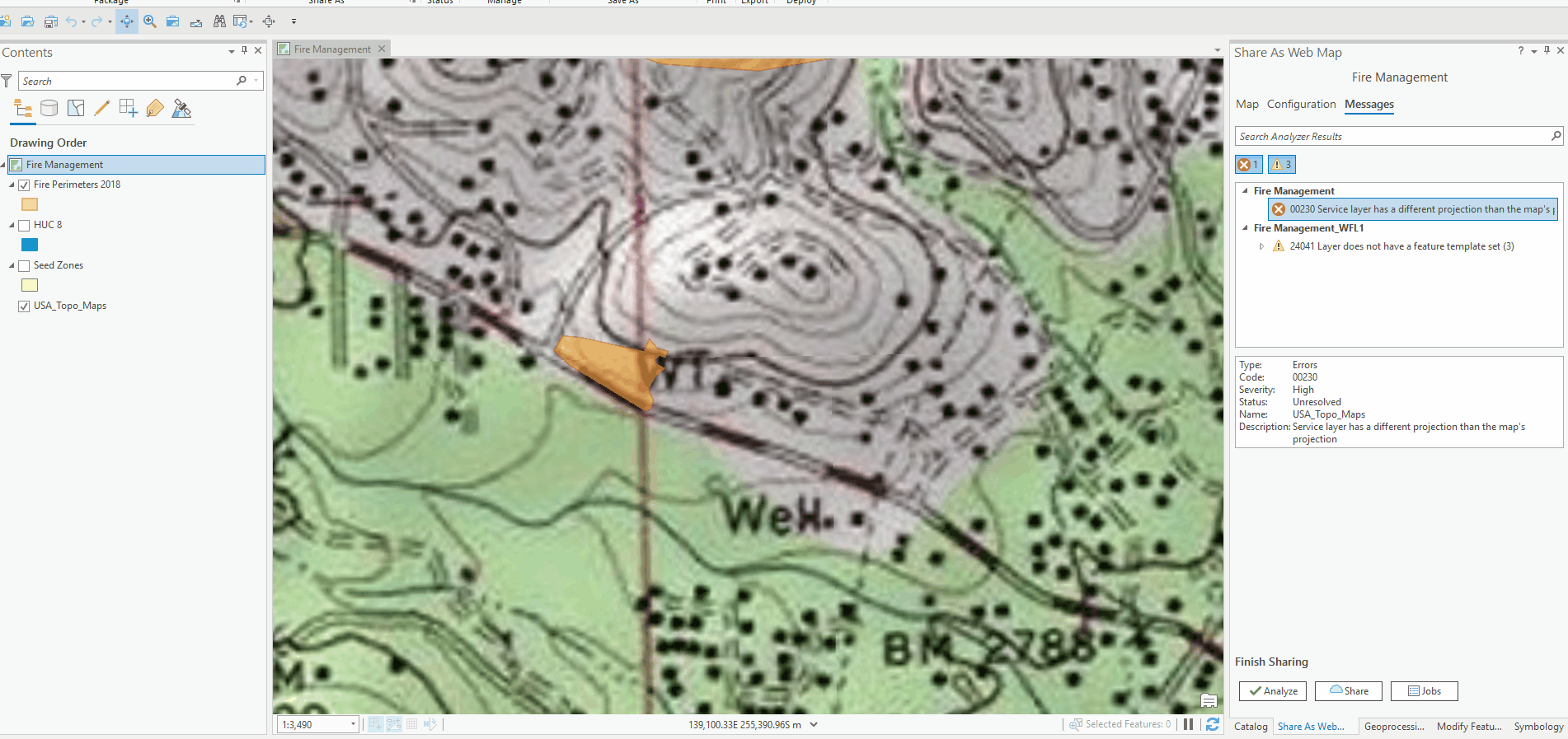
Hi, I am very new to ArcGIS Pro and I am trying to share a map I've made to my organization. I keep getting the error message 00230, which says "Service layer has a different projection than the map's projection" and when I click for further details, the basemap is being indicated as the layer with a different projection.
Solved! Go to Solution.
Accepted Solutions
- Mark as New
- Bookmark
- Subscribe
- Mute
- Subscribe to RSS Feed
- Permalink
Did you go through the Solutions section here?
- Mark as New
- Bookmark
- Subscribe
- Mute
- Subscribe to RSS Feed
- Permalink
Yes, but I don't know what this means: "use the provided default solution to automatically change the projection of your map or scene to match the projection of your basemap."
- Mark as New
- Bookmark
- Subscribe
- Mute
- Subscribe to RSS Feed
- Permalink
When I hover the mouse over them, my error messages don't have the option to click ellipses for more information.
- Mark as New
- Bookmark
- Subscribe
- Mute
- Subscribe to RSS Feed
- Permalink
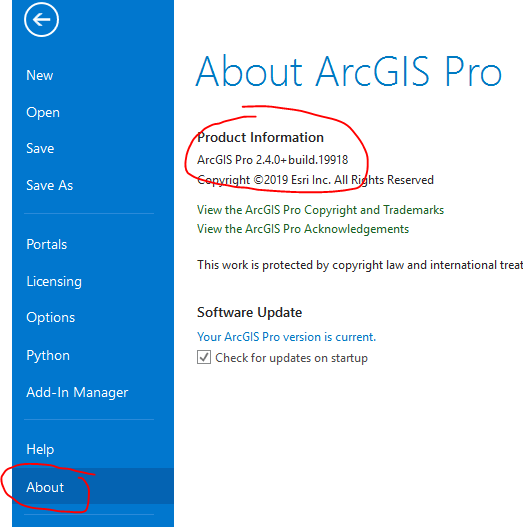
What version of ArcGIS Pro are you using? (Go to the Project tab to get to the Settings and then go to the About tab)
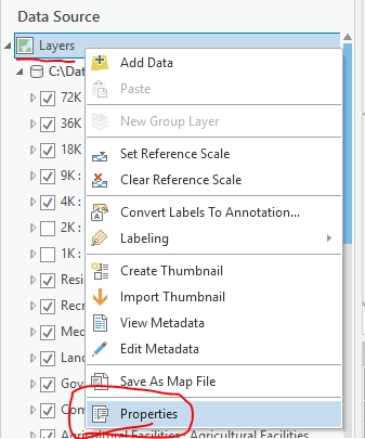
Even without the ellipsis, you can just open the Map Properties to get to that dialog:
- Mark as New
- Bookmark
- Subscribe
- Mute
- Subscribe to RSS Feed
- Permalink
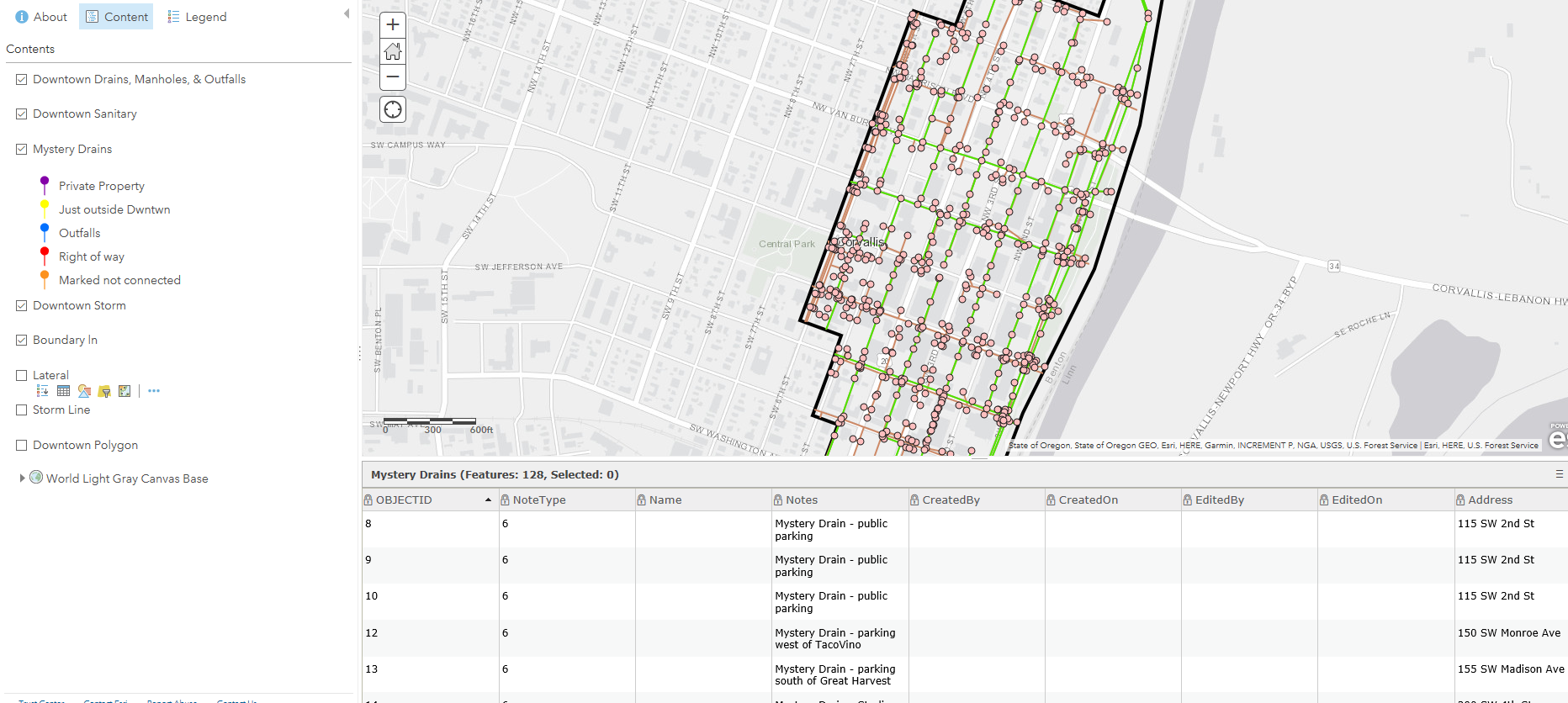
I am now using a different computer that has a newer version of ArcGIS Pro. I was able to share the map by making the changes to the projection. However, now I am having an issue with all of the data uploading to the online map. I created this map so I could share it with other people. I made 128 notes on the map using the point tool. When I uploaded the map the attribute table for all of the points is there, but the points are not showing up on the map. They appear in the content and the legend, but not actually on the map itself. I've tried zooming in and out to see if it's a visibility range issue, but that does not seem to be the case.
- Mark as New
- Bookmark
- Subscribe
- Mute
- Subscribe to RSS Feed
- Permalink
I have the same problem, but I want my layers in a different projection than the default one. Is there any way to change the basemap projection instead?
- Mark as New
- Bookmark
- Subscribe
- Mute
- Subscribe to RSS Feed
- Permalink
This is an interesting thread. I am not understanding how changing to Web Mercator is considered a "solution?" I am having this issue in Field Maps Designer where I created a layer to be used with my RTK unit. I like to collect my data in the local projection for my state so that's the projection my layer is in but when I go to open my map in Field Maps it won't open because of the projection of the basemap. This is so silly, why can't Field Maps use a transformation to project on the fly so I can still use the projection of my liking? This is anything but user friendly. Even if everything ultimately ends up in Web Mercator when it's published online I should still be able to collect my data in the projection that is most useful for me.
- Mark as New
- Bookmark
- Subscribe
- Mute
- Subscribe to RSS Feed
- Permalink
We just used this solution to keep our desired projection (state plane) for the web map and layers, rather than convert our layers to our standard basemaps (all web mercator):
How To: Use a Layer as a Basemap in ArcGIS Online and ArcGIS Pro