- Home
- :
- All Communities
- :
- Products
- :
- ArcGIS Pro
- :
- ArcGIS Pro Questions
- :
- Re: Dynamic Legends for Map Series in ArcGIS Pro
- Subscribe to RSS Feed
- Mark Topic as New
- Mark Topic as Read
- Float this Topic for Current User
- Bookmark
- Subscribe
- Mute
- Printer Friendly Page
Dynamic Legends for Map Series in ArcGIS Pro
- Mark as New
- Bookmark
- Subscribe
- Mute
- Subscribe to RSS Feed
- Permalink
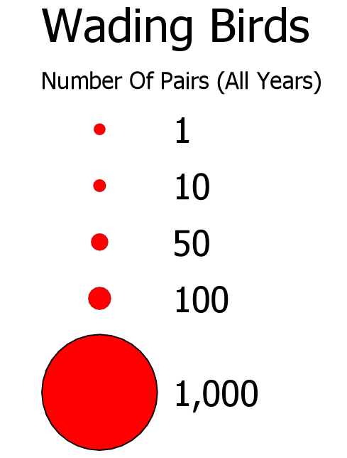
I am creating a "Map Series" in ArcGIS Pro 2.3.2. Each map depicts the number of nesting pairs of a specific species of wading birds found around the state. Some of the species are very common and others are not. Currently, the legend uses a "Proportional Symbols" type legend and the legend is the same for each of the maps in the series... stretching between the minimum (1) and maximum (1,000) values for all of the birds.
However, I wish to have the legend's maximum value dynamically change depending on the species. With a map series in Pro, is there a way to have the legend dynamically change and stretch between the minimum and maximum number of nesting pairs for a given species? My work-around would be to create a custom map for each species, which I am trying to avoid.
Thanks,
Roland
- Mark as New
- Bookmark
- Subscribe
- Mute
- Subscribe to RSS Feed
- Permalink
I'm looking for this feature also not only for proportional symbols but for choropleth maps. I would guess a python option could be a solution.
Any new information since the post in May 2019?
Thanks.
Brian
- Mark as New
- Bookmark
- Subscribe
- Mute
- Subscribe to RSS Feed
- Permalink
Hi Brian,
Yes, Python is often an option. I created many of these bird atlas maps using and automated Python approach. In this particular case (because there were about 12 wading bird species), I ended up creating individual maps, using custom symbols. There have been many changes/improvements with the software over the past year, so I suggest working with ArcGIS Pro version 2.5.0, as it is the most recent.
All The Best,
Roland
- Mark as New
- Bookmark
- Subscribe
- Mute
- Subscribe to RSS Feed
- Permalink
Thanks.