- Home
- :
- All Communities
- :
- Products
- :
- ArcGIS Pro
- :
- ArcGIS Pro Questions
- :
- Density of points
- Subscribe to RSS Feed
- Mark Topic as New
- Mark Topic as Read
- Float this Topic for Current User
- Bookmark
- Subscribe
- Mute
- Printer Friendly Page
Density of points
- Mark as New
- Bookmark
- Subscribe
- Mute
- Subscribe to RSS Feed
- Permalink
I have a couple point feature classes, where many of the points are fairly close to one another, does anyone have any good suggestions on how to calculate get the density/numbers of points within a specific area?
- Mark as New
- Bookmark
- Subscribe
- Mute
- Subscribe to RSS Feed
- Permalink
Hi Chad, you may want to search for Point Density and Kernel Density, they are similar but there are important differences between them.
If you want to use an aggregation method, I personally like to generate a grid of spatial bins, then count how many points are within each bin using the Spatial Join tool. Generate Tesselation is a great tool which can also produce a hexagonal grid of bins (Hexagons are the most complex regular shape that can be tessellated, and have equidistant centres to all their neighbours!).
- Mark as New
- Bookmark
- Subscribe
- Mute
- Subscribe to RSS Feed
- Permalink
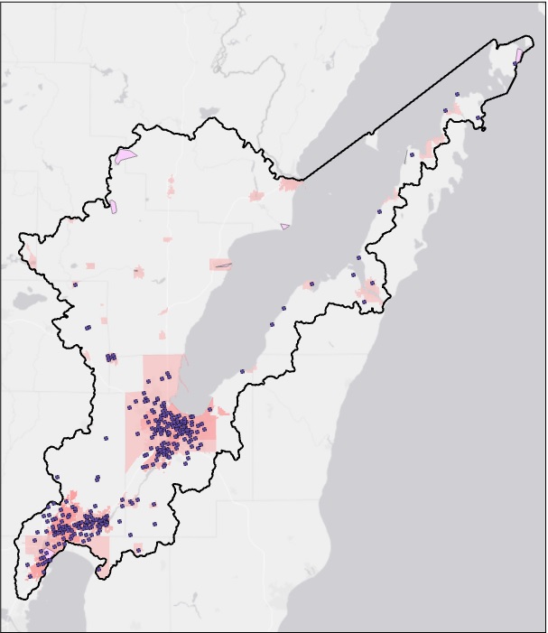
Thanks for the response David! I have been experimenting with the Point Density tool but the raster output seems a little cumbersome to work with and I cannot seem to build and/or generate a attribute table for the data. I have attached a image of the points I am trying to create density for.
- Mark as New
- Bookmark
- Subscribe
- Mute
- Subscribe to RSS Feed
- Permalink
Ah ok, those raster density outputs aren't really designed for attribution in a tabular form.
I'd highly recommend making that grid of hexagons (play about with the size you want) then do a spatial join based on those points.
- Mark as New
- Bookmark
- Subscribe
- Mute
- Subscribe to RSS Feed
- Permalink
Is there a specific tool that you use to create the Hexagons?
- Mark as New
- Bookmark
- Subscribe
- Mute
- Subscribe to RSS Feed
- Permalink
absolutely,
Generate Tessellation—Data Management toolbox | Documentation
this may not be available on your version of arcmap if its quite old however. The fishnet tool would be useful if not.
- Mark as New
- Bookmark
- Subscribe
- Mute
- Subscribe to RSS Feed
- Permalink
Thanks I will experiment some and see what I can find out.