Turn on suggestions
Auto-suggest helps you quickly narrow down your search results by suggesting possible matches as you type.
Cancel
- Home
- :
- All Communities
- :
- Products
- :
- ArcGIS Pro
- :
- ArcGIS Pro Ideas
- :
- Make Anchor/Pivot Point more visible
Options
- Subscribe to RSS Feed
- Mark as New
- Mark as Read
- Bookmark
- Follow this Idea
- Printer Friendly Page
- Report Inappropriate Content
- Mark as New
- Bookmark
- Subscribe
- Mute
- Subscribe to RSS Feed
- Permalink
- Report Inappropriate Content
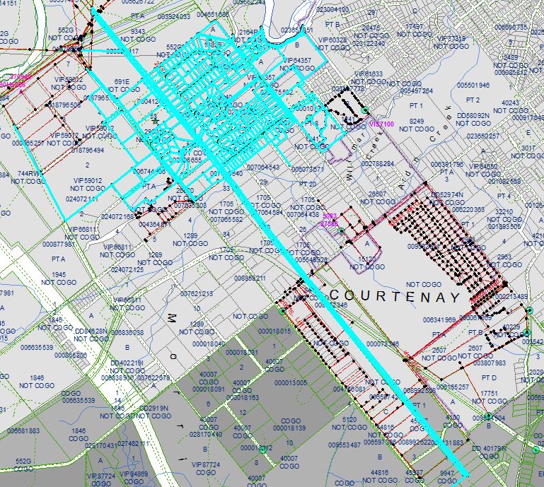
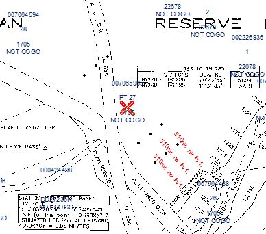
Any chance of making the anchor/pivot point more visible in ArcMap? We COGO and compile parcel lines and when doing so may need to move or rotate the lines. We normally have several base layers added. Not all are turned on and, in order to see this virtually invisible crosshair of an anchor point, we have to turn off the layers to find it amongst the selected lines. First image shows selected lines with anchor point hidden. Can you find the anchor point? Second image shows an added raster file with its pivot point in a very visible size and colour. It would make work a lot easier if the anchor/pivot point was more visible.


1 Comment
- Mark as Read
- Mark as New
- Bookmark
- Permalink
- Report Inappropriate Content
Or at least the ability to Flash it or something.
You must be a registered user to add a comment. If you've already registered, sign in. Otherwise, register and sign in.