Turn on suggestions
Auto-suggest helps you quickly narrow down your search results by suggesting possible matches as you type.
Cancel
- Home
- :
- All Communities
- :
- Products
- :
- ArcGIS Pro
- :
- ArcGIS Pro Ideas
- :
- Draw geometries accross 180
Options
- Subscribe to RSS Feed
- Mark as New
- Mark as Read
- Bookmark
- Follow this Idea
- Printer Friendly Page
- Mark as New
- Bookmark
- Subscribe
- Mute
- Subscribe to RSS Feed
- Permalink
Add the ability to visualize geometries that cross the 180 when in WGS84.
- « Previous
-
- 1
- 2
- Next »
13 Comments
Wow, i am going to promote this because i never knew you couldn't. I don't need this functionality, but i see how it would be invaluable for those who do.
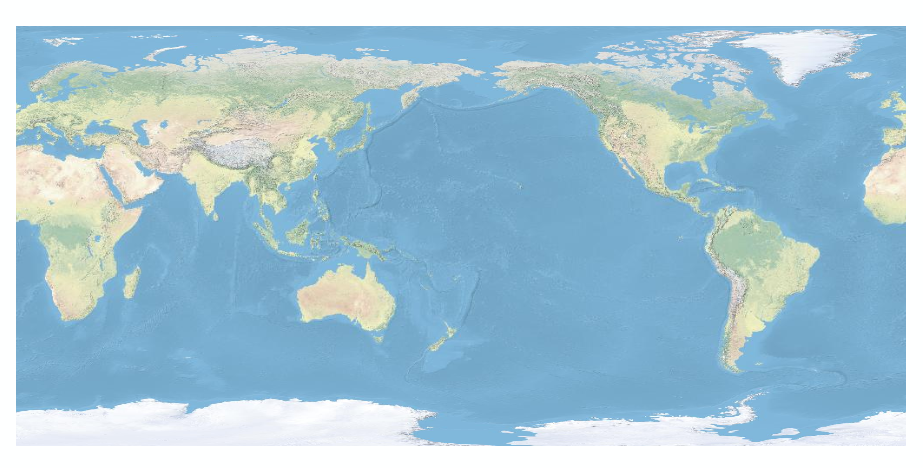
Krotte, you can visualize geometries across the 180 degree meridian in desktop if you use a custom projection on top of the WGS84 datum. We used this when doing buffers across the meridian in USFK. I liked to use the World Plate Carree projection because it looks nice on briefings and is pretty close to the WGS Geographics Default most use (although this works for other projections like web mercator as well). To do this put your data frame in a Projected Coordinate Systems > Plate Carree (World). Next modify the projection by changing the centeral meridian to 180 degrees. This will center your data frame on the Pacific. One thing to keep in mind is that if you use data layers in another projection they will have a line through them at the 180 degree longitude. To get around this do buffers and other created geometries in the modified projection directly and you'll get no line.
+1 for this one
This is real problem for those of us in New Zealand
If this inability is not a huge embarrassent to ESRI, it should be. How are we expected to show a flight from Japan to California?
ArcMap is on a computer, not a piece of paper!
ArcMap is on a computer, not a piece of paper!
Thank you for posting the idea. I am hoping I might get clarification from everyone who promoted this idea on what they are specifically looking for. As indicated by DougR, if you are looking to display the world in such a way that the 180 degree meridian is displayed in the center of the data frame when viewing the full extent of the world you can do this by customizing the data frame spatial reference. I have taken a screenshot of my map document with this setting applied. Is this the result everyone is looking to accomplish within ArcMap?

This works fine if you have a few geometries in a specific area but it if you have them all over the world it is not acceptable to keep changing the properties on your projection. Right now if you have a geometry that crosses the 180 it just falls off the world. A way to fix this would be to do a continuous wrap on the map. This would allow the user to just scrol to the area and have the geometries displayed correctly.
More than a year since the last post and there still doesn't appear to be a resolution to this problem. You cannot work in area specific coordinate systems when working with a global database and falling off the world is very dark ages.
Need a continuous wrap of geometries just tried to display a netcdf file with extent from -180.070313 tp 179.929688 . Fine in 2D with the Map properties set to wrap. But can't do the same in 3D globe so I get a stripe at 180. Would help sell ArcGIS Pro for us.
You must be a registered user to add a comment. If you've already registered, sign in. Otherwise, register and sign in.