- Home
- :
- All Communities
- :
- Products
- :
- ArcGIS Pro
- :
- ArcGIS Pro Ideas
- :
- ArcGIS Pro: Enable Right-Click Coordinate System ...
- Subscribe to RSS Feed
- Mark as New
- Mark as Read
- Bookmark
- Follow this Idea
- Printer Friendly Page
ArcGIS Pro: Enable Right-Click Coordinate System and Apply without Navigating from Map View
- Mark as New
- Bookmark
- Subscribe
- Mute
- Subscribe to RSS Feed
- Permalink
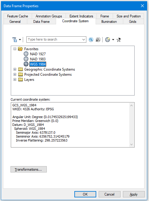
From the Dataframe or Layout view, ArcMap has right-click>data frame properties> coordinate system tab. The workflow allowed blazing fast identification and option to change the current dataframe coordinate system, and any necessary transformations. Not too mention (subjects for another day) all the other immediate, intuitive, and very handy tabs. All without navigating away from your map view (in background so you could even test without closing by clicking Apply!). Note you could even use a layer to make the changes. To do that is Pro, you must navigate the entire Catalog to the feature class, instead of picking an existing map layer from the dropdown:
If you needed to change the location units on the status bar, the general tab under the same right-click sequence had that for you instantly.
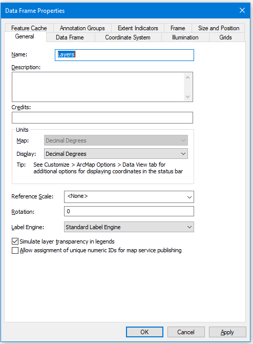
If you needed to change more options, note the handy "Tip" on the General Tab. So simple yet functional and intuitive.
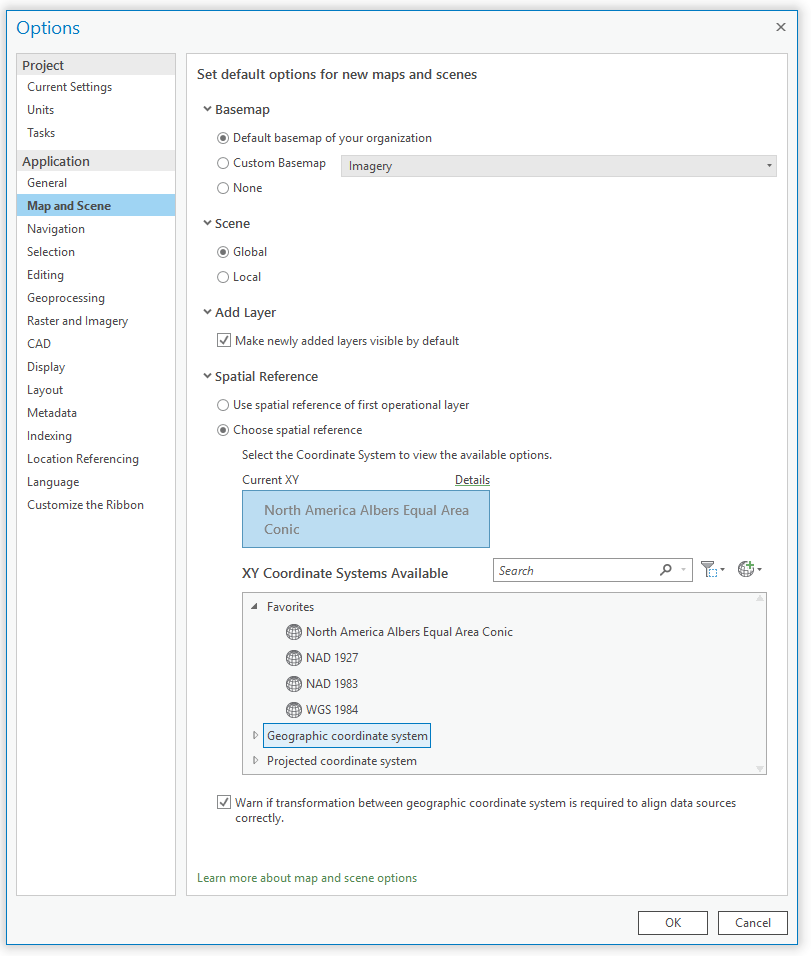
Please provide all aforementioned functionality for ArcGIS Pro - and make it work. Right now, part of the functionality appears available but does not respond. First off, you have to navigate away from your map or scene to Ribbon>Project>Options>Map and Scene>Spatial Reference. If you used the "Spatial Reference of the first operational layer", you better hope you remembered which that was, or which one "Import mxd" brought in. Otherwise, you're SOL, because it doesn't tell you. If you change it to "choose spatial reference", it doesn't respond. To change location reference, you must navigate to Project>Units. Thankfully this is on the same screen, so you don't have to navigate further from the map than you already are.
Note, this is NOT North America Albers Equal Area Conic:
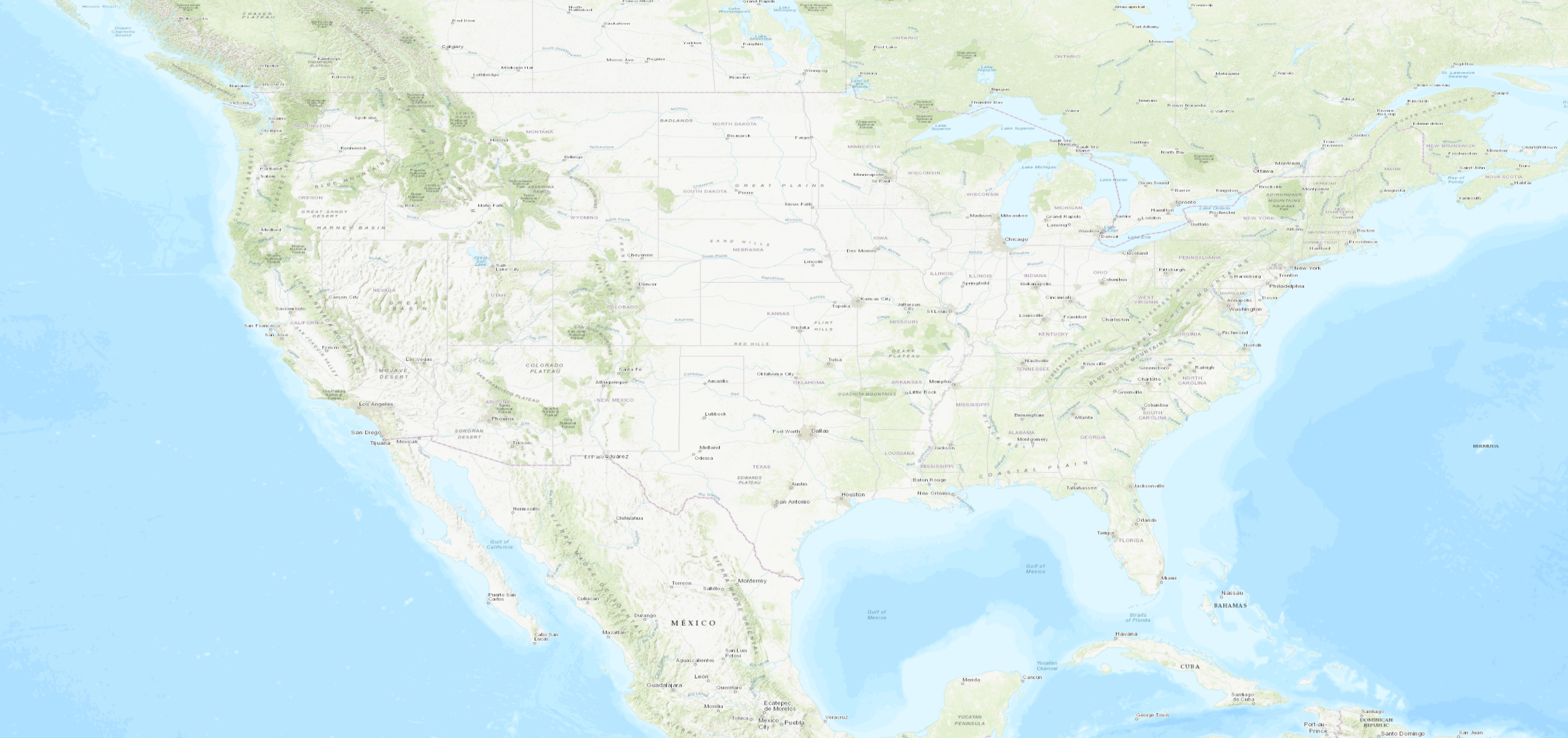
D T
To get more of an equivalent experience to opening the Data Frame properties, double-click or right-click > Properties on the map in the Contents pane in Pro. That opens up the map properties:

When I last closed mine it was on the Coordinate Systems tab so immediately opens to that. You can set a coordinate system based on your Favorites, other layers in the map, both listed first before you get to browsing through GCS or PCS:

The General tab allows you to directly set your display units:

The Map and Scene settings that you reference are settings at the Application level for new maps and scenes, not a current map:

To make changes to current map properties, use the double-click or right-click functionality.
Granted, there isn't an equivalent Apply functionality at this time which you do note in your description above.
I hope that this info is helpful!
Very helpful. I wasted almost an entire hour trying to fight this issue, before submitting this idea. All I wanted was a quick heat map with one layer on a standard topo basemap. Submitting here, by the way, is faster than waiting for a support case.
Also note to everyone... It's not just anywhere in the Contents pane - it's specifically on the word "Map".
It's absolutely ridiculous that even the smallest details from ArcMap aren't retained in Pro. ESRI obviously places no value on the thousands of dollars and man hours many of us analysts have invested in both formal and continuing education learning Desktop. Either that, or they place no value on time wasted on the clock. I've had to increase my workdays up to 12 to 16 hours trying to figure this mess out. I, and a lot of the folks in the user groups I attend, are at our wits end. In fact, I'm one of the last who even uses ESRI anymore. If we're going to be forced to start all over, we'll go somewhere else for cheaper. Together, we are figuring other ways to get things done. Apps like SpotFire, Open Source, and GlobalMapper, to name a few.
You must be a registered user to add a comment. If you've already registered, sign in. Otherwise, register and sign in.