I got a WGS84 GPS file in a region in Africa I have never worked in - and wanted to make a map in a suitable UTM projection. How to get it?
ArcGIS Pro has a cool feature to do so:
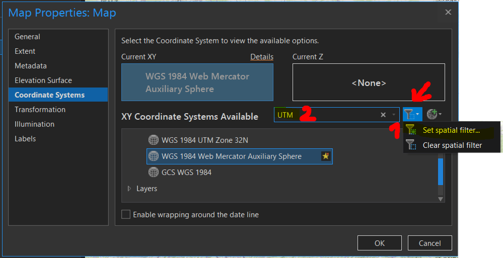
In the MapProperties - CoordinateSystems I was able to (1) set a spatial filter for suggested coordinate Systems by a layer (or known coordinates, or current extent, ...) and then search (in my case) for any UTM (2) zone that matches that area - done!
I think this is a pretty cool feature - helpful and straight forward! Like it!