I have developed a quick little python tool that combines the Merge Collinear Boundaries and the SLACA geoprocessing tools. This tool works fine on a copy of our PF data saved to my hard drive. Though when I try to use this tool on my versioned PF data I keep getting this error.
 RiverRunner1996_0-1759169495203.png
I hope this is just a parameter I need to adjust to get the tool to identify the versioned PF, but kinda at a loss as to what I need to adjust. As of now, my parameters for my input layers are set to "Feature Layer".
Here is my script being used and my parameter settings for context.
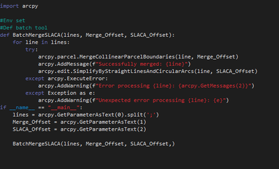 RiverRunner1996_1-1759169662591.png
 RiverRunner1996_2-1759170018557.png
Our PF data is hosted on SQL Server and published through our enterprise.
I am sure there is a parameter or line of code I am missing to get this to work. I appreciate any tips to get this working!

