- Home
- :
- All Communities
- :
- Products
- :
- ArcGIS Online
- :
- ArcGIS Online Questions
- :
- Suitability Analysis Help
- Subscribe to RSS Feed
- Mark Topic as New
- Mark Topic as Read
- Float this Topic for Current User
- Bookmark
- Subscribe
- Mute
- Printer Friendly Page
Suitability Analysis Help
- Mark as New
- Bookmark
- Subscribe
- Mute
- Subscribe to RSS Feed
- Permalink
Hi all,
I am looking for some advice on a GIS project I am working on. I am in my second GIS class so am looking for some tips on how to go about finishing my project. My project is basically a site suitability analysis. This is on ArcMap but assume ArcGIS online would be a good forum for advice.
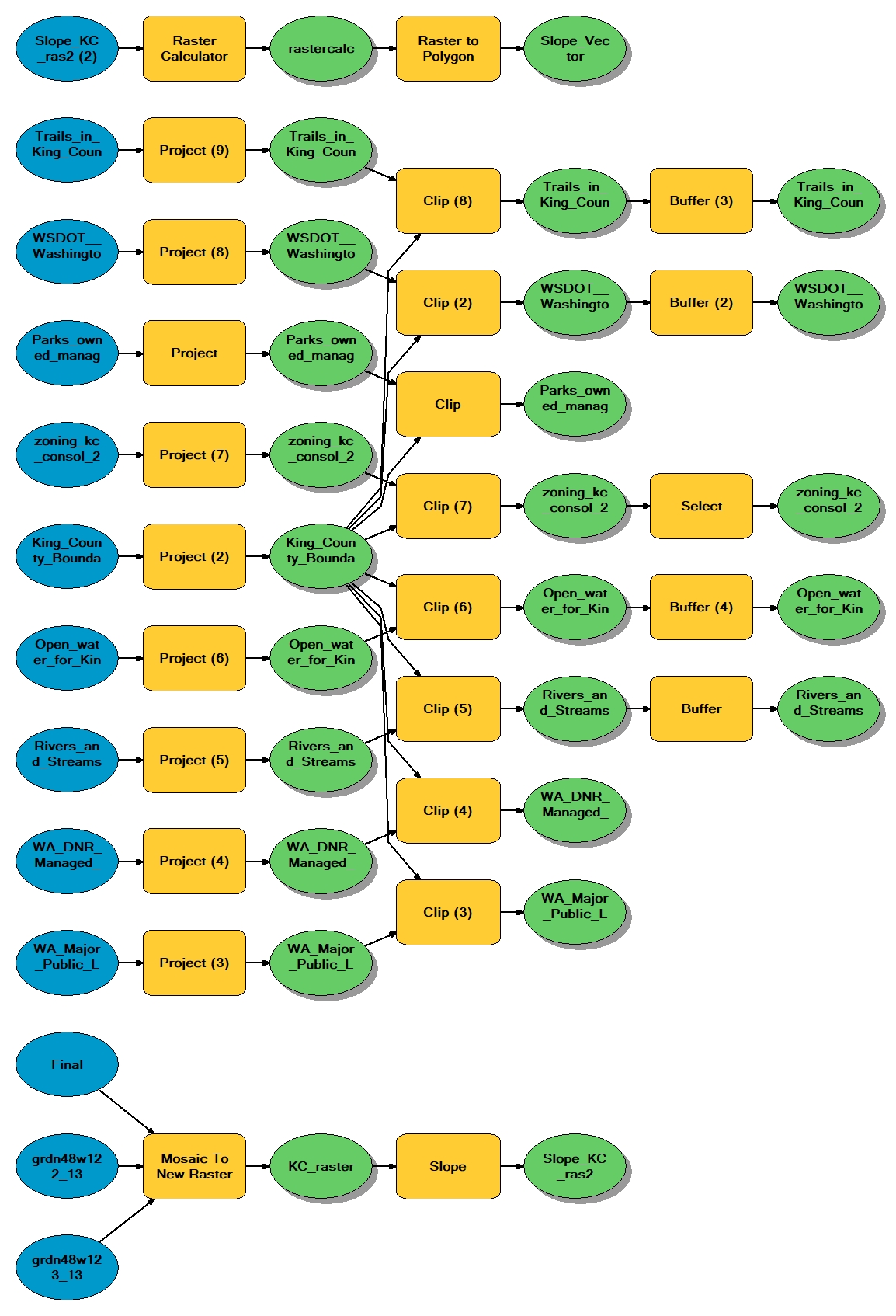
I am trying to locate possible areas for new campgrounds. In this project, I'm looking at locations that would be suitable for new campgrounds in King County Washington. My criteria include locations that are zoned as forests and rural areas, property owned by the County Parks Department, DNR, or Major Public Lands that also has to be: 1320 feet away from all roads, 1000 feet away from all streams and water bodies, and within 2640 feet of all trails, while also being on slopes that are less than 20 percent.
I have already selected out my rural areas and forests from my zoning data, brought in all the lands and parks data, processed the slope data and turned it into a polygon as well as put buffers with the distances on the needed features.
Where I am stuck is trying to find a way to tell ArcMap to look at intersections that are intersected with my lands data, and tails buffer, but that are not in my roads, streams, and waterways buffer. I am kind of looking for a reverse buffer that will also allow me to look at things that both are intersecting some layers but also what is outside a layers' buffers. I will attach my model of what I have done so far so you can get a better idea of where I am at.
Also, I know I could go back and do this with reclassifications, however, I would like to know if there is a way to do this based on what I have already done.
If anyone has any ideas on how to do this I am in desperate need of advice.
Thank you in advance!
- Mark as New
- Bookmark
- Subscribe
- Mute
- Subscribe to RSS Feed
- Permalink
Hi Benjamin, looks like you have everything set up.
Merge your roads and streams/hydro buffers into one feature and run the dissolve tool.
Use the erase tool to erase this buffer area from your possible sites.
Using your trails buffer, use the intersect to to create a new final feature class which represents your suitable areas. NB. Can also use clip tool instead if desired.
Merge—Help | ArcGIS for Desktop
Dissolve—Help | ArcGIS for Desktop
- Mark as New
- Bookmark
- Subscribe
- Mute
- Subscribe to RSS Feed
- Permalink
Thank you! This worked perfectly. I never even thought about dissolving the buffers let alone using the erase tool. You are a genius.
- Mark as New
- Bookmark
- Subscribe
- Mute
- Subscribe to RSS Feed
- Permalink
Ha, very far from that, but glad to help. Good luck with your project.