Hi all,
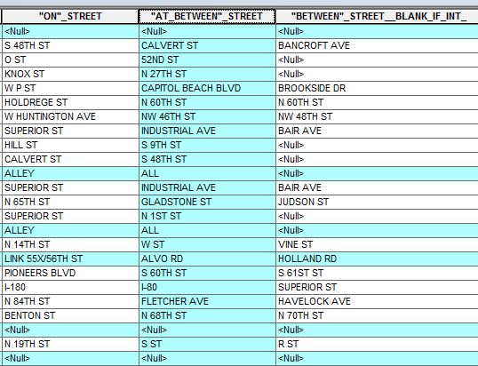
I have question in regards to geocoding accidents data. The data has (1)- "On" street, (2)- "At-between" street and (3)-"Between" street, which derived into incidents happened at (1) in between street (2) and (3).
I'm able to geocode intersection between (1) and (2) which came out to points feature class. However, that would not be entirely accurate, since some incidents data have (3).
How would I geocode a street segment, given the information from (1), (2) and (3). Below image shows a clip of the data that that shows the address information for the incidents.