- Home
- :
- All Communities
- :
- Products
- :
- ArcGIS Online
- :
- ArcGIS Online Questions
- :
- ArcGIS Online: Basemap Layer Data Source
- Subscribe to RSS Feed
- Mark Topic as New
- Mark Topic as Read
- Float this Topic for Current User
- Bookmark
- Subscribe
- Mute
- Printer Friendly Page
ArcGIS Online: Basemap Layer Data Source
- Mark as New
- Bookmark
- Subscribe
- Mute
- Subscribe to RSS Feed
- Permalink
Good Morning,
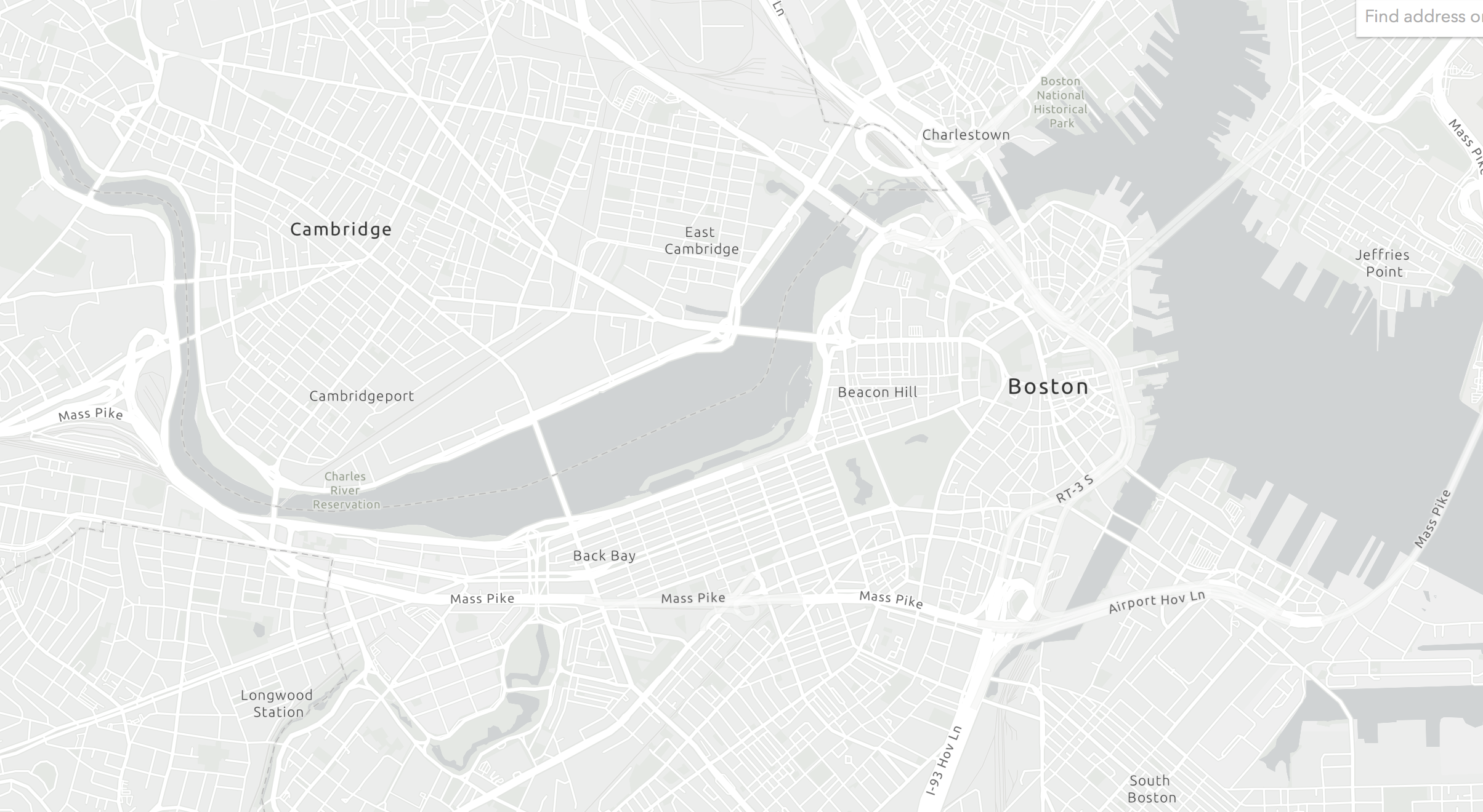
I am customizing the Light Grey Canvas vector basemap, and using this as my basemap in ArcGIS Pro. In ArcGIS pro, I need to clip some block group polygons using the light grey LAND area that appears on the basemap. The problem is, none of the datasets I have found in Portal / Living Atlas match the basemap land boundaries.
Does anyone know what data sources are being used to generate the land area on the default base maps? Boston has a very detailed coast in this area, with both rivers and oceans contributing--nothing I have tried so far seems to match up enough to make a clean overlay. The area I am focused on is in the image below.
Thank you!
- Mark as New
- Bookmark
- Subscribe
- Mute
- Subscribe to RSS Feed
- Permalink
I have the same issue! I've looked everywhere online and cannot find the data source for base maps. The ArcGIS Vector Tile Style Editor allows examination of the layers, but I cannot find the layers published independently to use for analysis.