- Home
- :
- All Communities
- :
- Products
- :
- ArcGIS Online
- :
- ArcGIS Online Ideas
- :
- Clip to Shape or Mask
- Subscribe to RSS Feed
- Mark as New
- Mark as Read
- Bookmark
- Follow this Idea
- Printer Friendly Page
- Mark as New
- Bookmark
- Subscribe
- Mute
- Subscribe to RSS Feed
- Permalink
Our Organization has several commonly used statewide layers that are used for various reasons. It would be nice to have the option to clip to shape or mask these statewide layers to a watershed polygon to better focus attention on the topic at hand. We can, of course, zoom in to the watershed of interest and highlight that area with a semi transparent polygon but when you are trying to simplify/clean the map for a quick map a mask would be preferable. We could also clip the data out into new feature services but this would cause us to do thousands of clippings and overwriting on a weekly bases.
Are any of your needs met with the perform analysis tools?: Perform analysis—ArcGIS Online Help | ArcGIS
-Kelly
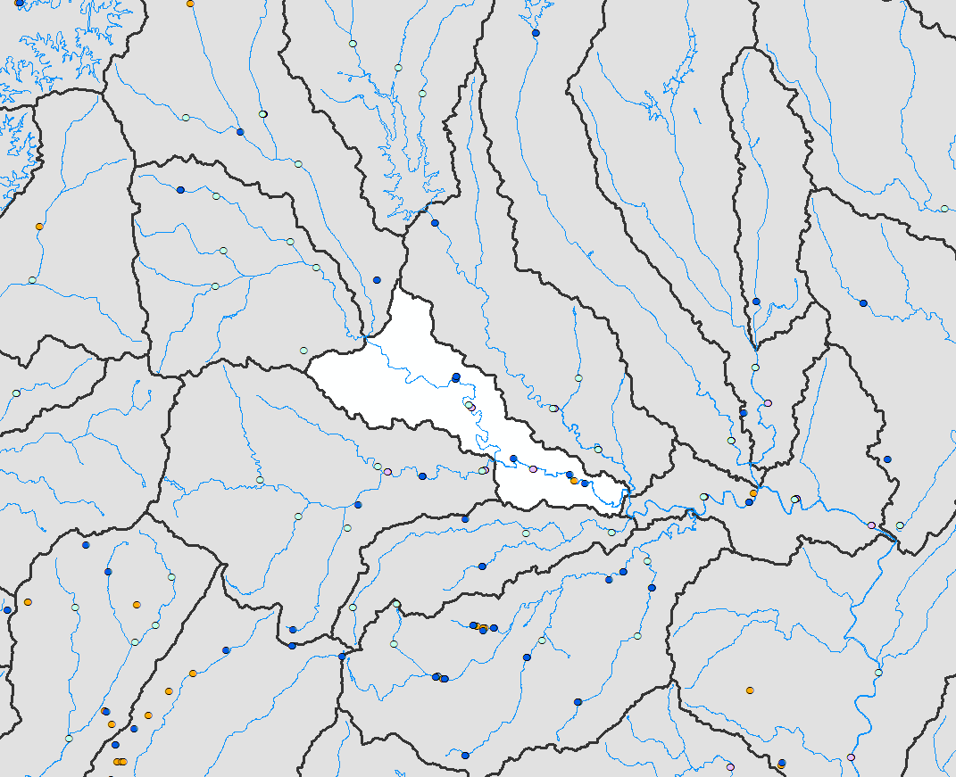
Unfortunately not. The Extract Data tool is the closest of these tools but I'm not looking to make new files. Rather, I need to stay connected to the existing statewide layers. In the image below, I would like to select the hollow polygon and only show the points in that polygon with all others points outside of that area masked. A map with the same data points will be made for each of these gray polygons so I would like to avoid making separate point layer files for each of the 1700 polygons. Also, those point files have data that updates about once a week/month so it would be extremely beneficial if I don't break the link to the original file. Thanks for the suggestion though!
Thanks for your reply Melanie! This is a really great description of the issue.
We also would love to see a masking option in ArcGIS Online. One project I am working on has a range of town areas that we want to highlight and in ArcGIS Pro we can mask out the surrounding areas but it does not publish to ArcGIS Online. It would be great for the masking functionality to be able to follow when publishing.
You must be a registered user to add a comment. If you've already registered, sign in. Otherwise, register and sign in.