- Home
- :
- All Communities
- :
- Products
- :
- ArcGIS Network Analyst
- :
- ArcGIS Network Analyst Questions
- :
- ArcGIS Pro 3.1 Network Connectivity
- Subscribe to RSS Feed
- Mark Topic as New
- Mark Topic as Read
- Float this Topic for Current User
- Bookmark
- Subscribe
- Mute
- Printer Friendly Page
- Mark as New
- Bookmark
- Subscribe
- Mute
- Subscribe to RSS Feed
- Permalink
Hello!
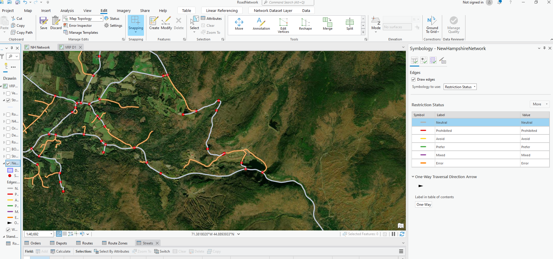
I am working on building a state road network from centerlines. I already data cleaned, established an elevation field, and built the network. I checked for connectivity and found that there are many errors or disconnected road segments (see picture below). What are some possible solutions or ways to connect them to the network? 
Solved! Go to Solution.
Accepted Solutions
- Mark as New
- Bookmark
- Subscribe
- Mute
- Subscribe to RSS Feed
- Permalink
Unfortunately the integrate tool found 0 matches for the tool to work.
However, I did finally find the root issue. I took a look at the network and symbolized it to show areas of errors. This prompted me to create a topology with a copy of the source data and although there were many dangles none of those appeared to be overshoots or undershoots, just normal end points for roads and highways. Thankfully found the issue was in the hierarchy attribute values, the network was not accepting values of 0 for "No Functional System" in the source data, a simple reclassification did the trick.
- Mark as New
- Bookmark
- Subscribe
- Mute
- Subscribe to RSS Feed
- Permalink
If the disconnected edges are due to undershoot or overshoot then you can look at using the Integrate tool. Make sure you run it on a COPY of your data as it will alter your data to make things connect. You have to evaluate the results to see if that is what you need. More info here:
Integrate (Data Management)—ArcGIS Pro | Documentation
Jay Sandhu
- Mark as New
- Bookmark
- Subscribe
- Mute
- Subscribe to RSS Feed
- Permalink
Unfortunately the integrate tool found 0 matches for the tool to work.
However, I did finally find the root issue. I took a look at the network and symbolized it to show areas of errors. This prompted me to create a topology with a copy of the source data and although there were many dangles none of those appeared to be overshoots or undershoots, just normal end points for roads and highways. Thankfully found the issue was in the hierarchy attribute values, the network was not accepting values of 0 for "No Functional System" in the source data, a simple reclassification did the trick.