For the 10.7.1 release of ArcGIS GeoEvent Server, we are excited to announce new documentation for the existing out-of-the-box input and output connectors. A separate documentation page has been provided for each connector that includes a summary, unique usage notes, list of properties help, and known limitations.
To access this content, you are welcome to visit the existing Available input connectors and Available output connector landing pages where you'll notice that the 10.7 version of the documentation includes links for each of the existing connectors in place of the original text-based list. Clicking on any of these links will bring you to the new documentation for the specified connector. Additionally, you can view the new material as a list by accessing the Input connectors and Output connector topics under Connect to Data and Send Updates and Alerts.

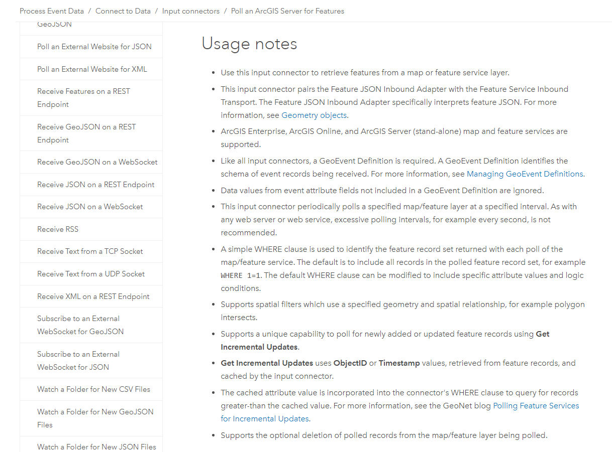
As mentioned before, the new documentation for each input and output connector includes unique usage notes. These usage notes are intended to help provide additional information about each connector. You'll find information regarding best practices, tips-and-tricks, expected behavior, references to additional documentation, and configuration considerations.
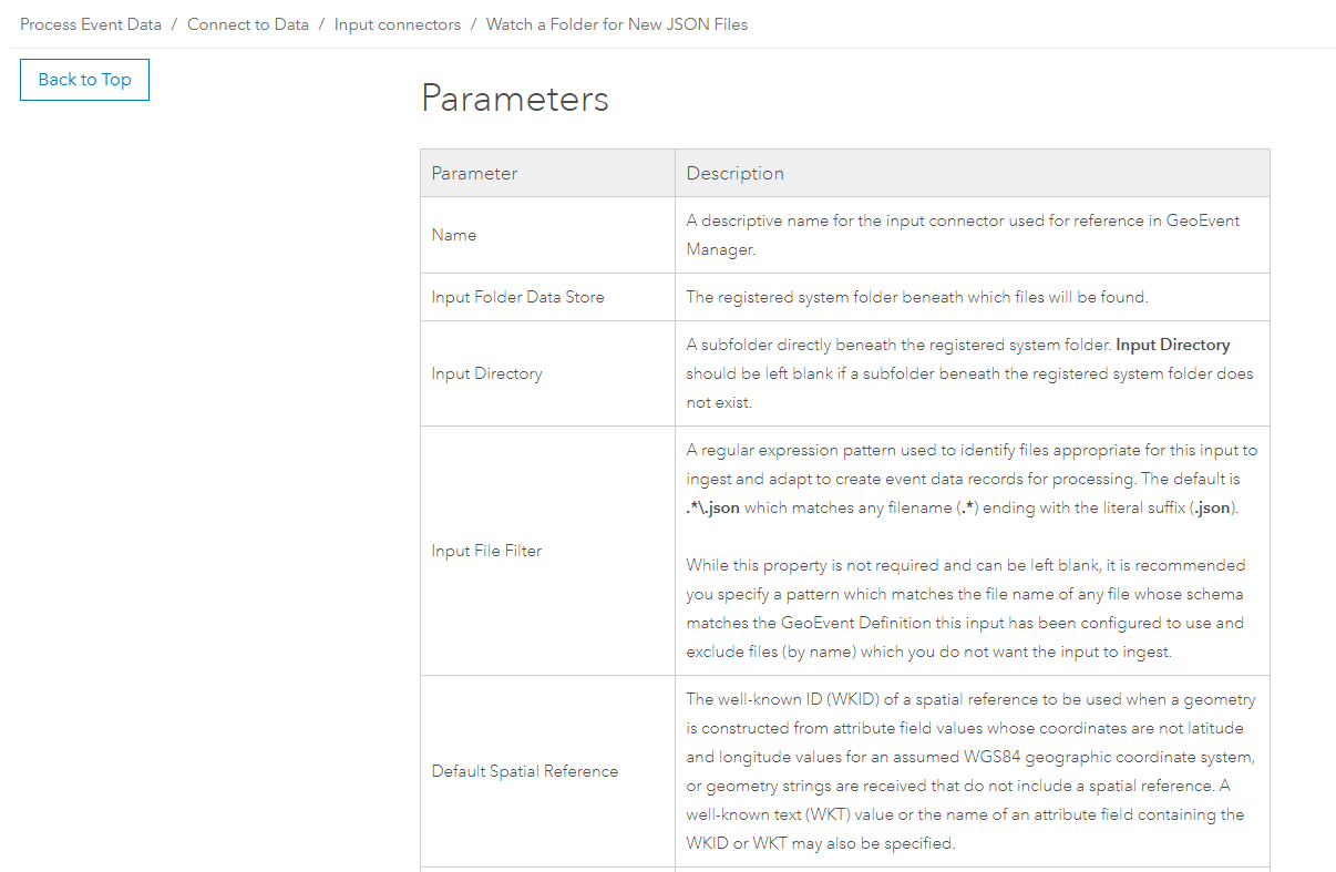
Below the usage notes for each input and output connector are a complete list of available parameters. It is worth noting that the parameters in the list include all of those which are shown by default as well as those which are hidden since they are "conditional" (or dependent) on other parameters being configured a certain way to then first appear. You'll find that each parameter is paired with a unique description that explains what the parameter is for, what configurable options are available, what the expected input value(s) may be, and in some cases what the default value is.
As always, step-by-step documentation on how to configure various input and output connectors can be found in our existing tutorial-based documentation here: ArcGIS GeoEvent Server Gallery.