- Home
- :
- All Communities
- :
- Products
- :
- ArcGIS Explorer Desktop (Retired)
- :
- ArcGIS Explorer Desktop Questions
- :
- ARCGIS Desktop Explorer
- Subscribe to RSS Feed
- Mark Topic as New
- Mark Topic as Read
- Float this Topic for Current User
- Bookmark
- Subscribe
- Mute
- Printer Friendly Page
ARCGIS Desktop Explorer
- Mark as New
- Bookmark
- Subscribe
- Mute
- Subscribe to RSS Feed
- Permalink
Hello!
I received a folder containing a shapefile for Southwest Virginia Base Mapping. It essentially breaks virginia up into a bunch of squares.
What I need is to label those squares by the name assigned to it. If I hover over the squares, the name does pop up, but if I could create a layer that would place all the names in the squares, that would be perfect!
I attached the base file, that should have all the information on it.
- Mark as New
- Bookmark
- Subscribe
- Mute
- Subscribe to RSS Feed
- Permalink
Michael,
ArcGIS Explorer doesn't have labeling functionality for feature layers. If you have ArcMap you can label the features in ArcMap, save a layer file and use the layer file in ArcGIS Explorer Desktop. ArcGIS Explorer does honor the labeling for layer files.
If all you have is ArcGIS Explorer Desktop you could do the following to get labels.
Open the attribute table for the layer in ArcGIS Explorer
From the Table window click the save button.
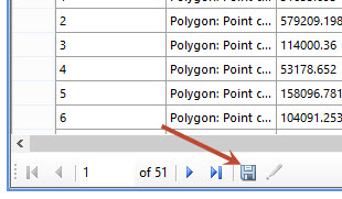
This will create a text file containing all of the cetroids for your polygons.
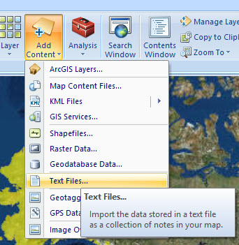
Next, add the text file to ArcGIS Explorer
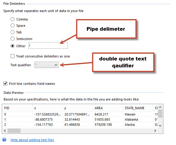
Set the separator and text qualifier
Set the XY fields and choose the field to use as a label.
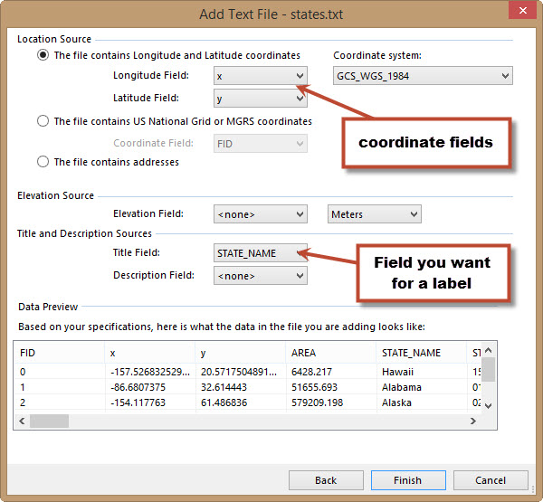
Click Finish
This will add Point notes to ArcGIS Explorer at the centroid for all of your polygons.
Shift Select all of the notes in the table of contents
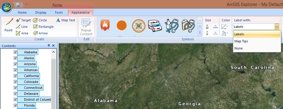
On the point note appearance tab you can turn on labels and set the symbol to transparent.

Mark