Turn on suggestions
Auto-suggest helps you quickly narrow down your search results by suggesting possible matches as you type.
Cancel
- Home
- :
- All Communities
- :
- Products
- :
- ArcGIS Explorer Desktop (Retired)
- :
- ArcGIS Explorer Desktop Questions
- :
- 1700 Spatial Query does not list notes for point l...
Options
- Subscribe to RSS Feed
- Mark Topic as New
- Mark Topic as Read
- Float this Topic for Current User
- Bookmark
- Subscribe
- Mute
- Printer Friendly Page
1700 Spatial Query does not list notes for point layer
Subscribe
5377
9
06-21-2011 01:18 PM
06-21-2011
01:18 PM
- Mark as New
- Bookmark
- Subscribe
- Mute
- Subscribe to RSS Feed
- Permalink
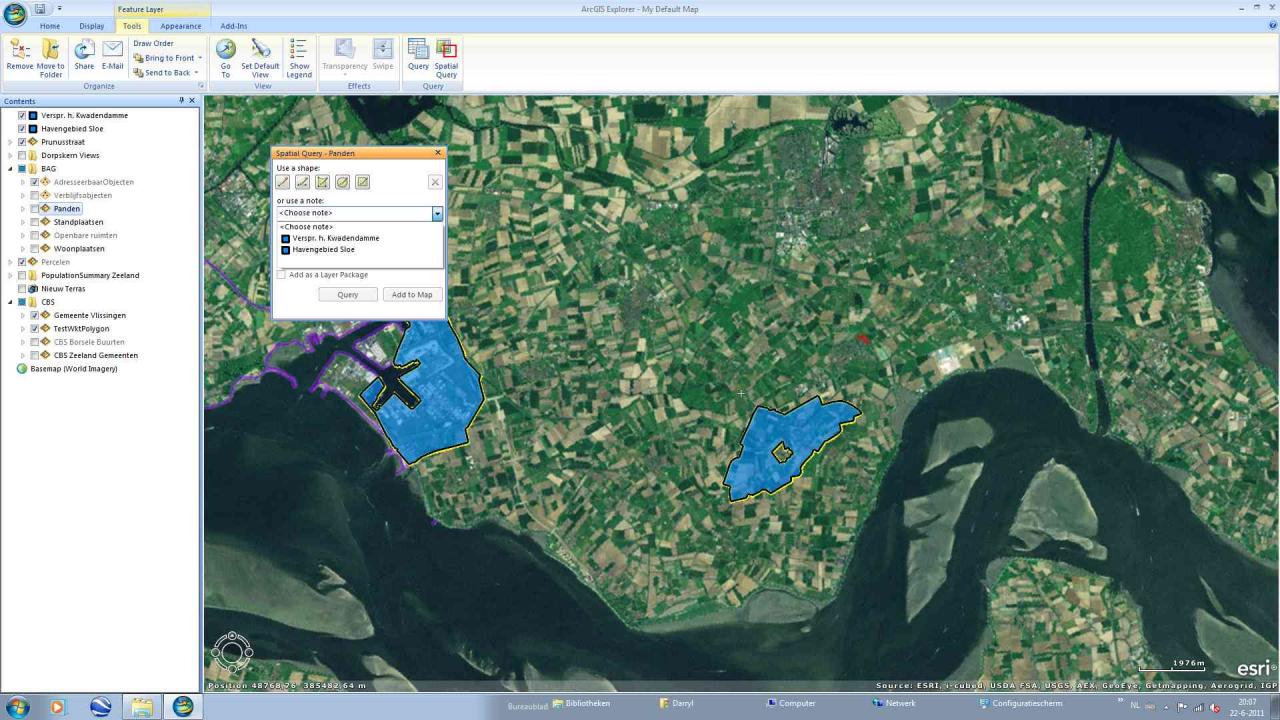
The new Spatial Query button in 1700 is most welcome.
However we've noticed a strange phenomenon:
If an area layer is selected, users' notes are visible in the combo for selecting a note as the query shape.
If a point layer is selected no notes are available in the combo which forces the user to draw the query shape by hand when querying point layers
Imprecise and frustrating.
Most of our notes are polygons.
Do others have the same problem?
9 Replies
06-22-2011
10:24 AM
- Mark as New
- Bookmark
- Subscribe
- Mute
- Subscribe to RSS Feed
- Permalink
Thanks for the quick reply, Andrij.
This occurrs on my test computer (Windows 7).
On a work computer (Windows XP) the notes are indeed available as query feature for point layers.
I have made a screenshot from my test computer where you can see that no notes are available for a (shape) point layer and another screenshot where an area layer has been selected and the notes are then visible.
Unfortunately clicking on the attachments button does nothing, even though the screen says I may post them If you can help me to get the button working I will send the screenshots and any other info you may require.
06-24-2011
11:04 AM
- Mark as New
- Bookmark
- Subscribe
- Mute
- Subscribe to RSS Feed
- Permalink
Darryl, can you share your data? You can privately share it, so I can take a look at what's going on, otherwise, it is tough to reproduce.
06-24-2011
12:26 PM
- Mark as New
- Bookmark
- Subscribe
- Mute
- Subscribe to RSS Feed
- Permalink
No problem Andriy.
Most of the features are in a (compressed) file gdb of 2MB.
The shape layers are quite large, but it's probably not necessary to upload them since the problem also occurrs with gdb point layers.
The nmc is tiny.
Let me know what you need and how best to do it ..
Most of the features are in a (compressed) file gdb of 2MB.
The shape layers are quite large, but it's probably not necessary to upload them since the problem also occurrs with gdb point layers.
The nmc is tiny.
Let me know what you need and how best to do it ..
06-24-2011
01:44 PM
- Mark as New
- Bookmark
- Subscribe
- Mute
- Subscribe to RSS Feed
- Permalink
just attach it to the forum. i will take a look at it.
06-28-2011
06:39 AM
- Mark as New
- Bookmark
- Subscribe
- Mute
- Subscribe to RSS Feed
- Permalink
Not really surprising, Andriy. It seems to have something to do with my test computer or it's operating system, Windows 7. No one else on the forum seems to have this problem. I'm thinking about doing a clean install of AGX1700 and starting from scratch with an empty map, to see if that helps.
Thanks for your efforts.
Thanks for your efforts.