- Home
- :
- All Communities
- :
- Products
- :
- ArcGIS Enterprise
- :
- ArcGIS Enterprise Questions
- :
- 300 Layers
- Subscribe to RSS Feed
- Mark Topic as New
- Mark Topic as Read
- Float this Topic for Current User
- Bookmark
- Subscribe
- Mute
- Printer Friendly Page
300 Layers
- Mark as New
- Bookmark
- Subscribe
- Mute
- Subscribe to RSS Feed
- Permalink
What is the best approach to manage an webmap with 300 layers?
(the layers should not be visible on map)
What is they best way to achive that while keeping the capabilities of the layers customization through the portal for arcigs?
Br,
Dvir.
- Mark as New
- Bookmark
- Subscribe
- Mute
- Subscribe to RSS Feed
- Permalink
Hi Dvir,
> The problem it's not with 'create' but with deploy and maintance it's will difficulte.
Many customers have deployed multiple Web AppBuilder apps for different purposes, for example:
Région des Pays de la Loire portal
> I think that it's not make sense to deploy and maintaince 20 webmaps for the same application.
Actually, you would have 20 different web maps (each only containing the specific layers of interest for a given category) for the different web apps.
> Is there any option maybe (with some code) to not load the layers in the webmap in webapp builder.
I am not aware of any such option, but you may want to post your question in this forum,
https://community.esri.com/groups/web-app-builder-custom-widgets
Hope this helps,
https://twitter.com/GIS_Bandit/status/974691227491684352
https://twitter.com/GIS_Bandit/status/974691227491684352https://twitter.com/GIS_Bandit/status/974691227491684352
https://twitter.com/GIS_Bandit/status/974691227491684352
- Mark as New
- Bookmark
- Subscribe
- Mute
- Subscribe to RSS Feed
- Permalink
One additional thought is that since ESRI has partnered with Latitude Geographics, and their software such as Geocortex Essentials is designed to work specifically with ESRI ArcGIS software, and is now integrated with use of Web AppBuilder (WAB). There might be some potentially useful functionality there in custom WAB widgets to help solve the dilemma of dealing with 300 layers in on app.
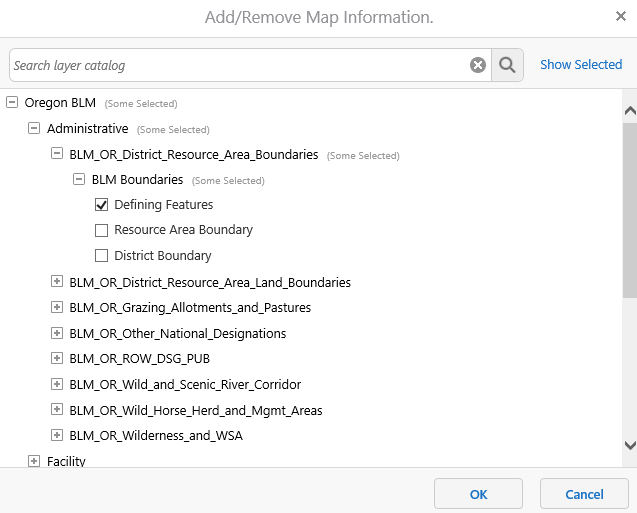
Geocortex Essentials added a "Layer Catalog" capability to their software suite: 
My coworker implemented this in one of his Geocortex Apps and it's pretty slick. You just open it and it enables "search layer catalog," or you can browse and select the layers you want to add to the web map from the layer catalog.
To give this a whirl and to see this in action go to the following hyperlink:
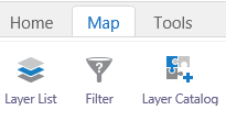
Once the Viewer is launched, click on the Map tab <*hint: upper left corner>
Then click on the Layer Catalog button as shown in the screenshot below:
Select the layer, and add it to the map:
Maybe Geocortex will build this into a widget that will work in WAB, or maybe they already have. It might be worth looking into in this use-case.
- « Previous
-
- 1
- 2
- Next »
- « Previous
-
- 1
- 2
- Next »