Turn on suggestions
Auto-suggest helps you quickly narrow down your search results by suggesting possible matches as you type.
Cancel
- Home
- :
- All Communities
- :
- Products
- :
- ArcGIS Earth
- :
- ArcGIS Earth Questions
- :
- More than one Terrain source error
Options
- Subscribe to RSS Feed
- Mark Topic as New
- Mark Topic as Read
- Float this Topic for Current User
- Bookmark
- Subscribe
- Mute
- Printer Friendly Page
More than one Terrain source error
Subscribe
1253
1
05-02-2020 11:26 AM
05-02-2020
11:26 AM
- Mark as New
- Bookmark
- Subscribe
- Mute
- Subscribe to RSS Feed
- Permalink
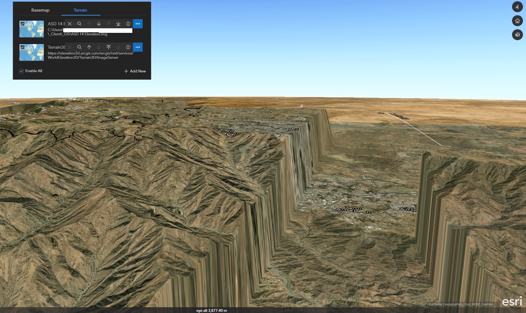
Hi, I've been trying to add some more detailed 10 m resolution DEM (as a IMG file stored locally on my machine). I'm adding that as a Terrain source, sitting above the Esri global elevation layer. However despite both data sources being set to visible, the Esri source does not appear when I got my own DEM switched on (creating a very steep cliff and flat earth!).
Any idea what I'm doing wrong?
Bruno
1 Reply
05-07-2020
11:00 PM
- Mark as New
- Bookmark
- Subscribe
- Mute
- Subscribe to RSS Feed
- Permalink
Hi Bruno,
Thanks for your feedback.
Earth displays terrain according to the order of your terrain sources panel. There is a bad interpretation of no-data cells in a local raster. It does not render well when the LoD change of the Esri global elevation layer.
We will let you know when this issue is fixed.
Thanks,
Xuewen