- Home
- :
- All Communities
- :
- User Groups
- :
- ArcGIS Desktop Deutschland
- :
- Questions
- :
- Quick Export
- Subscribe to RSS Feed
- Mark Topic as New
- Mark Topic as Read
- Float this Topic for Current User
- Bookmark
- Subscribe
- Mute
- Printer Friendly Page
Quick Export
- Mark as New
- Bookmark
- Subscribe
- Mute
- Subscribe to RSS Feed
- Permalink
Hi All,
I have recently acquired ArcGIS Desktop Standard and the main reason for this purchase is to be able process raster (ascii) and export the results in Mapinfo and or shape file format.
As mthe first task, I have processed a raster and sharing some the raster contents below:
Attributes table of the Raster

Raster in Map

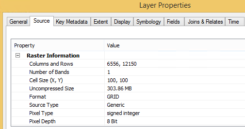
Raster type and cell size info
Now I want to do 2 things
- Dissolve the data - The issue is the above raster is not available in "Input Features" for selection. I tried to save it as a layer (*.lyr), but I get an invalid layer error message
- Quick Export the dissolved file into Mapifo type polygon (*.tab), I do have the Data Interoperability extension license. Similar to dissolve, the *lyr file is deemed invalid.
I tried and saved as different layer types and yet nothing seems to work.
Please help by point me in the right direction?
Thanks,
Donne
- Mark as New
- Bookmark
- Subscribe
- Mute
- Subscribe to RSS Feed
- Permalink
Both Dissolve or Export to MapInfo format (.TAB) (using Quick Export) needs Feature Layer/Feature Class as input. Raster data are not supported.
As a first step, you could convert the Raster to Polygon Feature Class. Then, you could use the Polygon Feature Class as inputs of the desired geoprocessing tools.
Think Location
- Mark as New
- Bookmark
- Subscribe
- Mute
- Subscribe to RSS Feed
- Permalink
Jayanta,
It has worked beautifully.
Many thanks
Donne