- Home
- :
- All Communities
- :
- Products
- :
- ArcGIS Data Reviewer
- :
- ArcGIS Data Reviewer Questions
- :
- Data Reviewer: Creating a Grid w/ Coordinate Syste...
- Subscribe to RSS Feed
- Mark Topic as New
- Mark Topic as Read
- Float this Topic for Current User
- Bookmark
- Subscribe
- Mute
- Printer Friendly Page
Data Reviewer: Creating a Grid w/ Coordinate System
- Mark as New
- Bookmark
- Subscribe
- Mute
- Subscribe to RSS Feed
- Permalink
I would like to create a grid for an Attribute Assistant with the Coordinate System option. Seems easy enough, but I was thinking there would be a MinX MinY, MaxX MaxY dialogue but the wizard only presents a Begin X Begin Y value. Okay, what ever; I provide the xy for the lower left corner of my study area (see attached) in whole state plane feet. [edit]: The grid shown in the screen capture is the default 10x10 cell size using a bounding box. and they measure 4800' wide by 8650' tall. I've tried creating a grid 6000' x 6000', 2500'x 2500' and 1000'x1000' all with the same failure.
What's the trick to creating a grid this way?
- Mark as New
- Bookmark
- Subscribe
- Mute
- Subscribe to RSS Feed
- Permalink
The Start X and Start Y should default to 0. If you want to set the extent of the area to create the grid, you do that in the previous UI. If you want to base it on a coordinate, there is an option to enter to do that. You will have to enter four sets of coordinates.
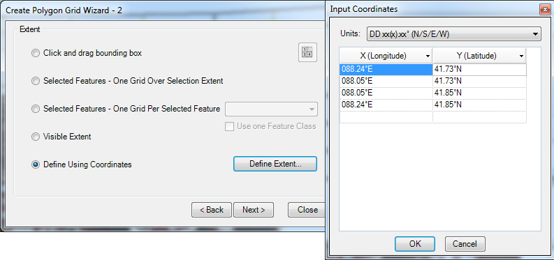
Hope that helps.
michellej.
- Mark as New
- Bookmark
- Subscribe
- Mute
- Subscribe to RSS Feed
- Permalink
Thanks Michelle- too bad it won't accept State Plane coords. For us old guys, four sets of coordinates (DD or DMS), without negative numbers but having to add NEWS is breaking old habits...
edited moments later:
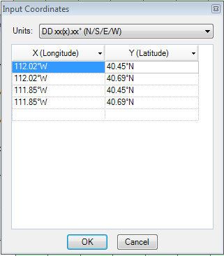
results with:
- Mark as New
- Bookmark
- Subscribe
- Mute
- Subscribe to RSS Feed
- Permalink
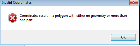
I received the same message when I first entered the coordinates too. Make sure you enter them in clockwise order as if you were digitizing a polygon. So try switching the bottom two rows of coordinates.