Turn on suggestions
Auto-suggest helps you quickly narrow down your search results by suggesting possible matches as you type.
Cancel
- Home
- :
- All Communities
- :
- Products
- :
- ArcGIS CityEngine
- :
- ArcGIS CityEngine Questions
- :
- Black Terrain Textures
Options
- Subscribe to RSS Feed
- Mark Topic as New
- Mark Topic as Read
- Float this Topic for Current User
- Bookmark
- Subscribe
- Mute
- Printer Friendly Page
Black Terrain Textures
Subscribe
2073
2
04-04-2014 01:12 PM
04-04-2014
01:12 PM
- Mark as New
- Bookmark
- Subscribe
- Mute
- Subscribe to RSS Feed
- Permalink
Hi!
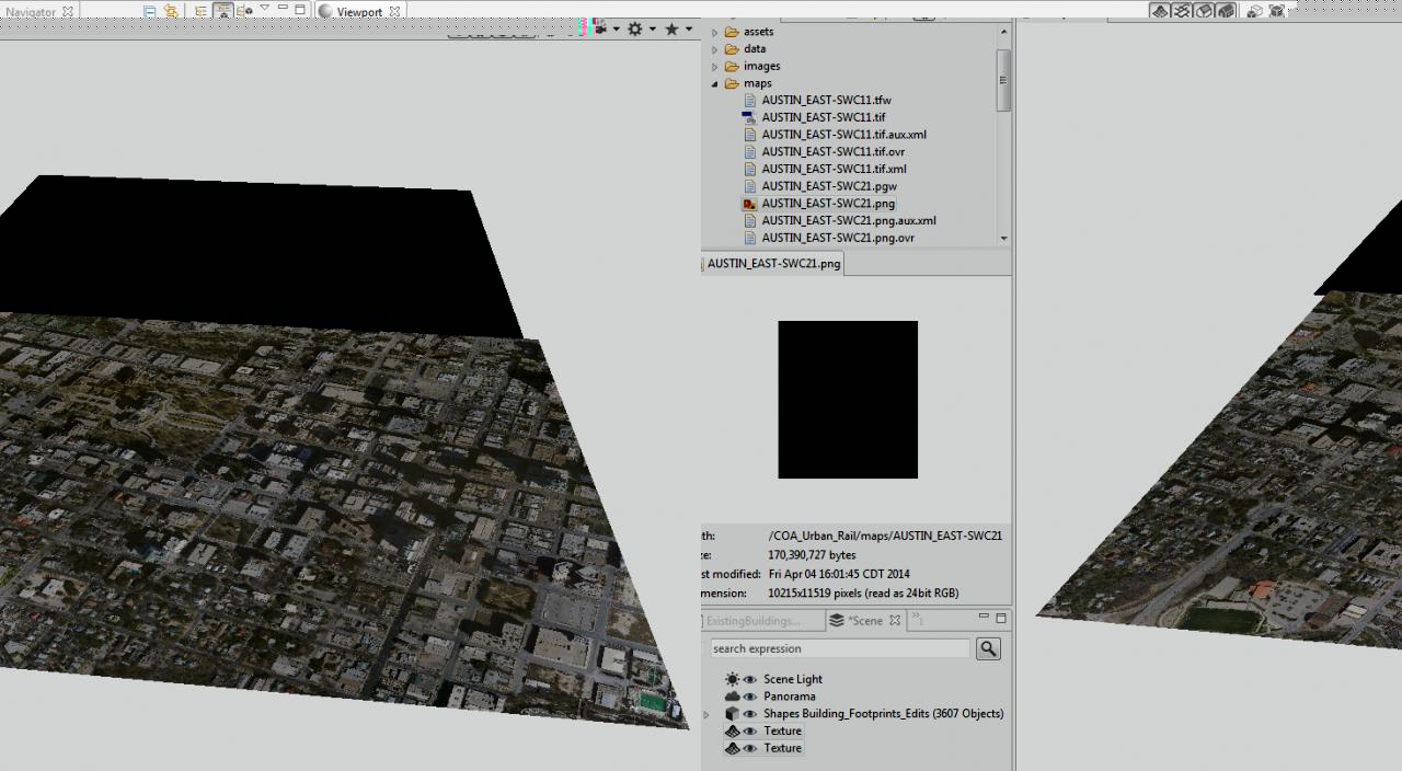
I have some aerial imagery that I'm trying to import into CE, but it frequently shows up black. What have been the best solutions for figuring out why this happens?
[ATTACH=CONFIG]32824[/ATTACH]
In the above image, I am only using the terrain as a texture layer, but it is georeferenced. I originally had a bunch of JP2 files in ArcMap and then exported them to get either TIFs or PNGs so that CE could read the files. For some reason, only one TIF out of many works...
Ideas? This isn't the first problem I've had with black imagery, not sure what's going on.
Thanks!
2 Replies
04-04-2014
01:40 PM
- Mark as New
- Bookmark
- Subscribe
- Mute
- Subscribe to RSS Feed
- Permalink
SORRY!!! I found the answer here:
http://forums.arcgis.com/threads/66223-Rectified-images-from-ArcGIS-10.1-appear-black-in-other-softw...
Basically, I had an 8-bit image and the export function of ArcMap 10.1 automatically changes it to 16-bit. The solution is to make the "NoData as" field empty.
http://forums.arcgis.com/threads/66223-Rectified-images-from-ArcGIS-10.1-appear-black-in-other-softw...
Basically, I had an 8-bit image and the export function of ArcMap 10.1 automatically changes it to 16-bit. The solution is to make the "NoData as" field empty.
04-08-2014
01:07 AM
- Mark as New
- Bookmark
- Subscribe
- Mute
- Subscribe to RSS Feed
- Permalink
Hi !
Glad you found it !
Matt
Glad you found it !
Matt