- Home
- :
- All Communities
- :
- Products
- :
- 3D
- :
- 3D Questions
- :
- revit model on gispro2.2?
- Subscribe to RSS Feed
- Mark Topic as New
- Mark Topic as Read
- Float this Topic for Current User
- Bookmark
- Subscribe
- Mute
- Printer Friendly Page
revit model on gispro2.2?
- Mark as New
- Bookmark
- Subscribe
- Mute
- Subscribe to RSS Feed
- Permalink
Hi hala almomani.
Before you just start to work make sure to create a copy of your .rvt archive and save it in a different place.
1. First of all you should have the location of your building (where it is on the map)!
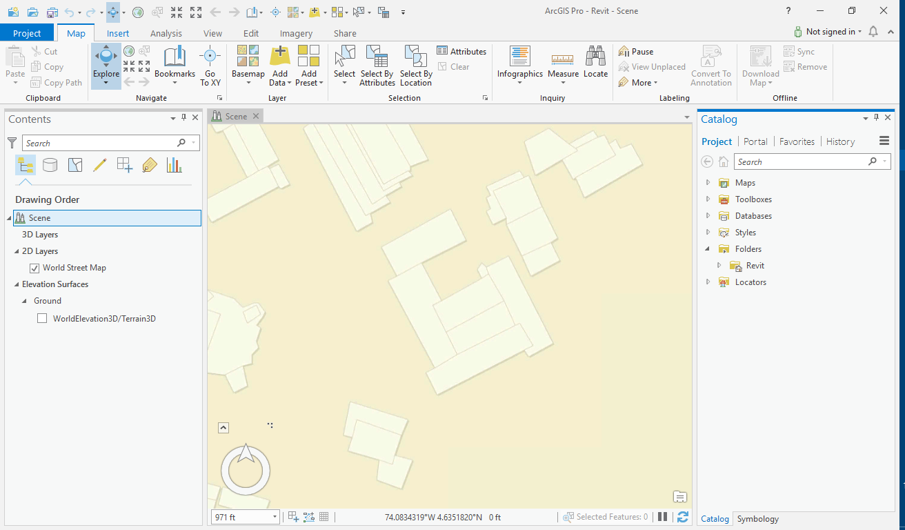
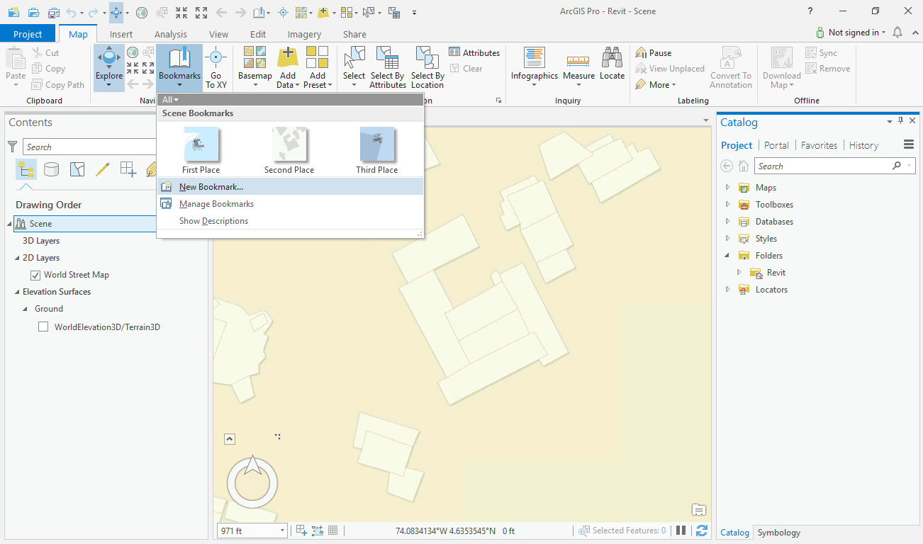
2. Then you need to find this location on one of ESRI base-maps (for ex. Streets or OpenSteertMap) in ArcGIS Pro and on the Map menu create a bookmark of this location.
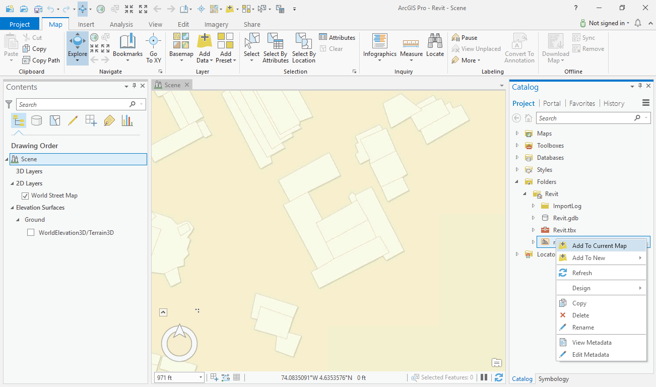
3. After this go to the folder where you have your .rvt archive and right click on it and point to Add To Current Map.
4. When your .rvt layer appeared in the Contents panel, click on ExteriorShelln (Doesn't matter if you can see the building or not). Now you can see a new menu option on top of ArcGIS Pro names Manage.
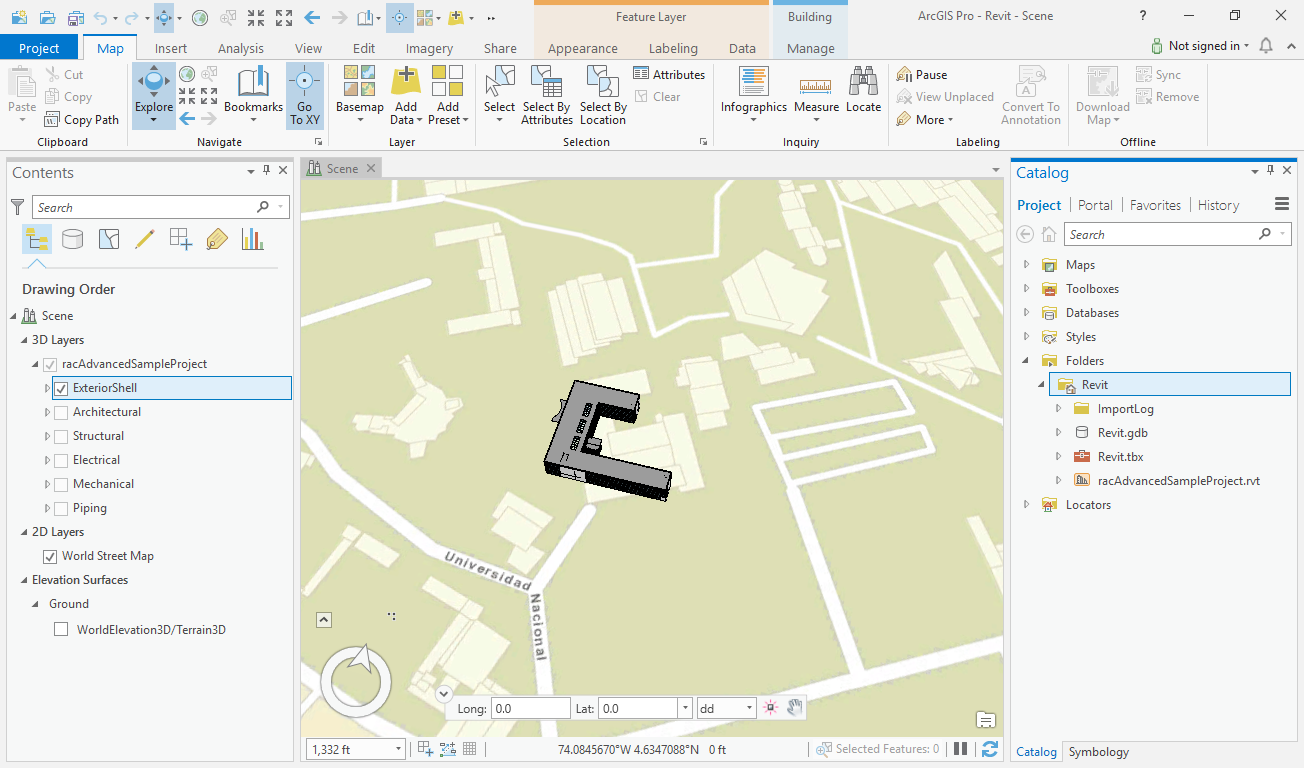
5. Now go to Manage and then click on Georeference . When the Georeference menu just appeared, click on Move to Display and then click Save.
But remember that after any change you make, clock Save option!
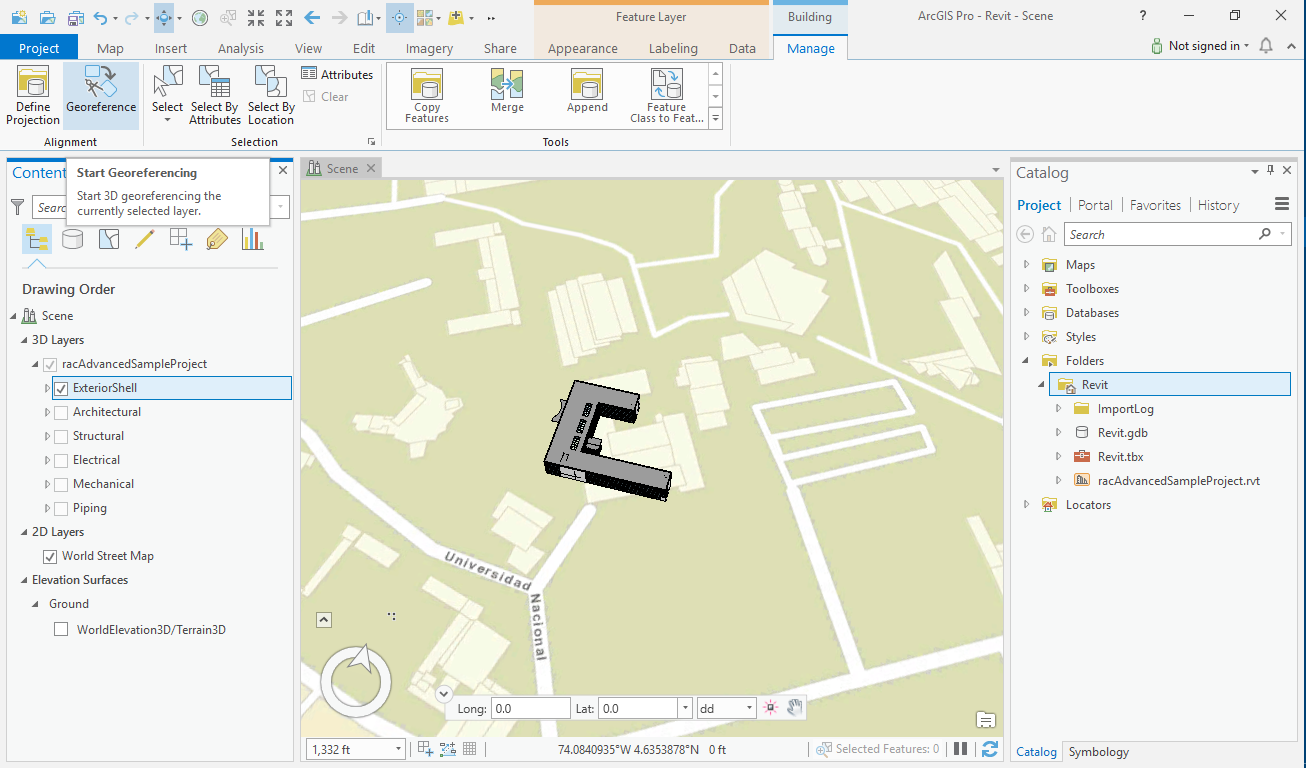

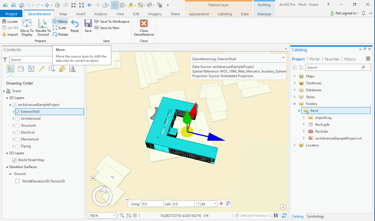
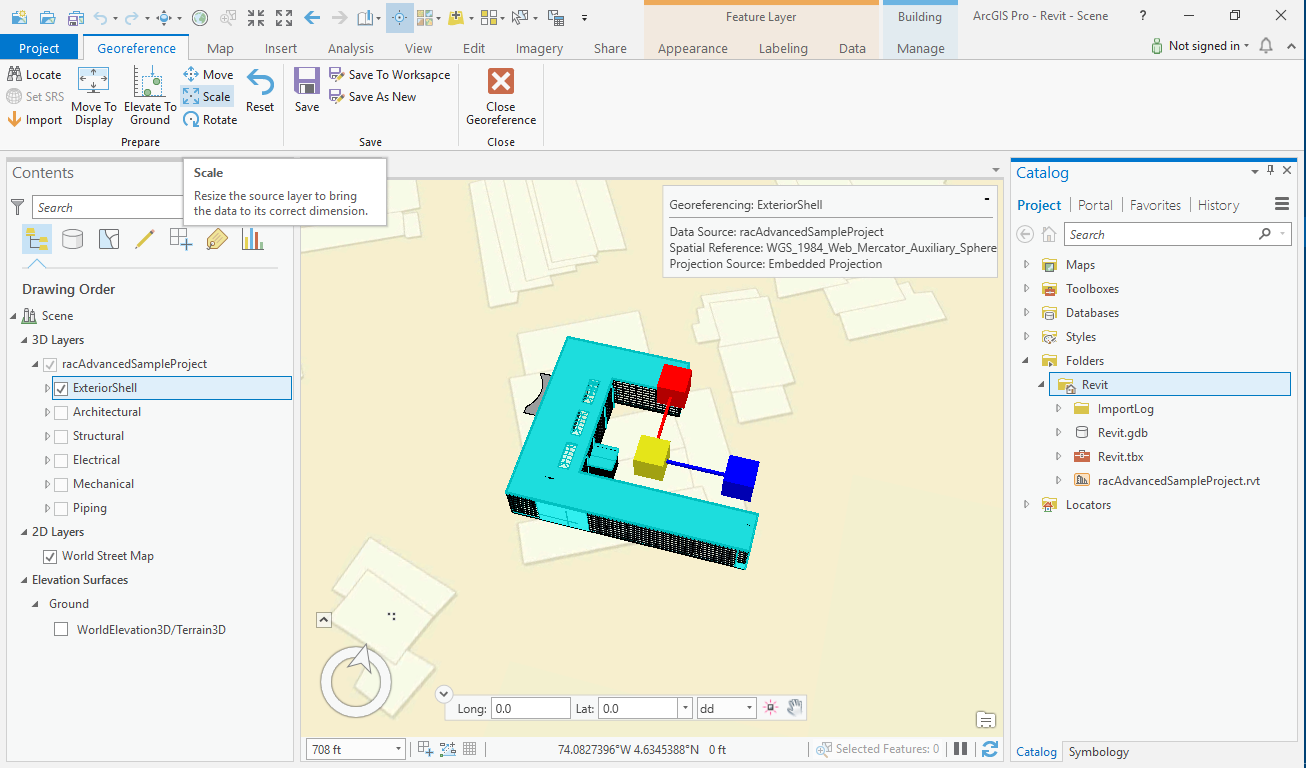
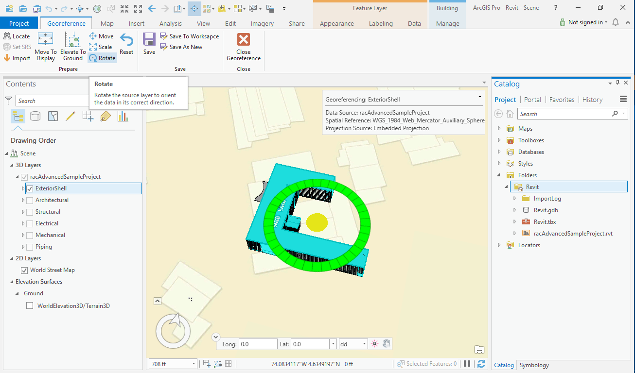
In continue you can use Move, Scale and Rotate options in order to have a better view of your building.
Good luck.
Proficient in best practices and uses of Esri's ArcGIS technologies.
- Mark as New
- Bookmark
- Subscribe
- Mute
- Subscribe to RSS Feed
- Permalink
that's so helpful , thank you so much for these steps
i will try it
- Mark as New
- Bookmark
- Subscribe
- Mute
- Subscribe to RSS Feed
- Permalink
I also used these steps to Load a Revit model as well. It is really good if the original Revit model has 'real world' coordinates. NOTE: Big Revit models take a while to load though and don't do it across a network.
- Mark as New
- Bookmark
- Subscribe
- Mute
- Subscribe to RSS Feed
- Permalink
i tried these steps and it worked, but i do not use the survey point in the revit .
- Mark as New
- Bookmark
- Subscribe
- Mute
- Subscribe to RSS Feed
- Permalink
It looks like these threads are related: