Turn on suggestions
Auto-suggest helps you quickly narrow down your search results by suggesting possible matches as you type.
Cancel
- Home
- :
- All Communities
- :
- Products
- :
- 3D
- :
- 3D Questions
- :
- Re: problem of the display the lidar dataset in ar...
Options
- Subscribe to RSS Feed
- Mark Topic as New
- Mark Topic as Read
- Float this Topic for Current User
- Bookmark
- Subscribe
- Mute
- Printer Friendly Page
problem of the display the lidar dataset in arcscene
Subscribe
4304
1
09-05-2013 09:01 PM
09-05-2013
09:01 PM
- Mark as New
- Bookmark
- Subscribe
- Mute
- Subscribe to RSS Feed
- Permalink
[ATTACH=CONFIG]27251[/ATTACH][ATTACH=CONFIG]27252[/ATTACH][ATTACH=CONFIG]27253[/ATTACH]
Hi,
i got the footprint,lidar data and aerial photo which i need to use for constructing urban 3d model. i saw some tutorials online, but there is one problem for me.
i can open lidar dataset in arcmap (as showd in picture 1 - ground lidar dataset), there are many points in 2d.
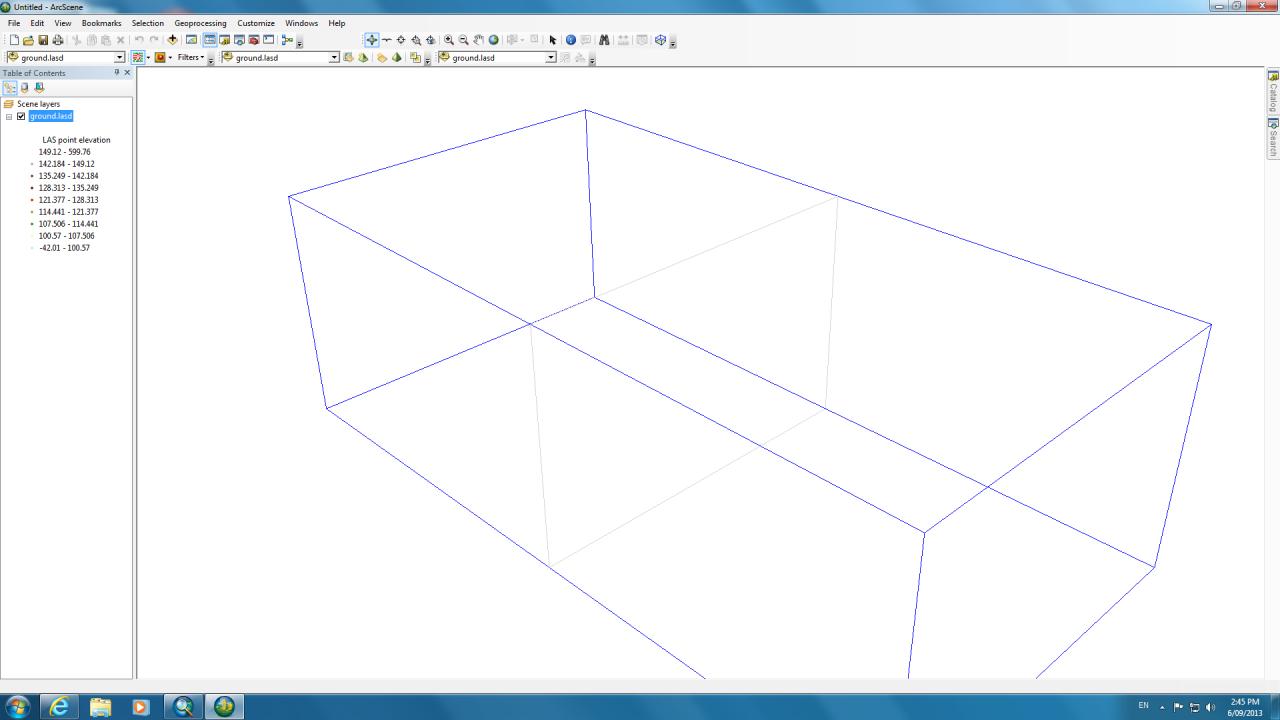
but when i open it in arcscene 10.1, first several seconds there is a just a box (picture 2), after that nothing shows in the arcscene.
but i saw online tutorial, they all can open las dataset in acrscene like cloudy points.
Hi,
i got the footprint,lidar data and aerial photo which i need to use for constructing urban 3d model. i saw some tutorials online, but there is one problem for me.
i can open lidar dataset in arcmap (as showd in picture 1 - ground lidar dataset), there are many points in 2d.
but when i open it in arcscene 10.1, first several seconds there is a just a box (picture 2), after that nothing shows in the arcscene.
but i saw online tutorial, they all can open las dataset in acrscene like cloudy points.
1 Reply
09-09-2013
02:10 AM
- Mark as New
- Bookmark
- Subscribe
- Mute
- Subscribe to RSS Feed
- Permalink
[ATTACH=CONFIG]27251[/ATTACH][ATTACH=CONFIG]27252[/ATTACH][ATTACH=CONFIG]27253[/ATTACH]
Hi,
i got the footprint,lidar data and aerial photo which i need to use for constructing urban 3d model. i saw some tutorials online, but there is one problem for me.
i can open lidar dataset in arcmap (as showd in picture 1 - ground lidar dataset), there are many points in 2d.
but when i open it in arcscene 10.1, first several seconds there is a just a box (picture 2), after that nothing shows in the arcscene.
but i saw online tutorial, they all can open las dataset in acrscene like cloudy points.
Hi Yang,
Maybe the amount of data causes this effect. You could try to reduce the amount of data to be displayed by using the "Area of Interest tool" in ArcScene. More info here:
http://resources.arcgis.com/en/help/main/10.1/index.html#//00q800000144000000
Kind regards,
Xander