- Home
- :
- All Communities
- :
- Products
- :
- 3D
- :
- 3D Mapping Questions
- :
- Create silhouette of 3d city model using Skyline 3...
- Subscribe to RSS Feed
- Mark Topic as New
- Mark Topic as Read
- Float this Topic for Current User
- Bookmark
- Subscribe
- Mute
- Printer Friendly Page
Create silhouette of 3d city model using Skyline 3D Analyst in ArcGIS
- Mark as New
- Bookmark
- Subscribe
- Mute
- Subscribe to RSS Feed
- Permalink
Hi all,
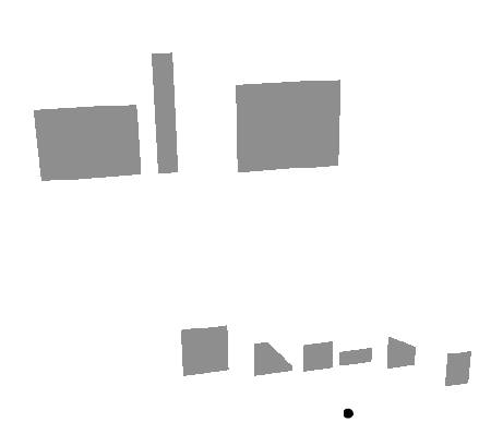
I have some question about visibility analyst in 3D Analyst in ArcGIS. I want to create silhouette of a 3d city model from observation point. For that, I had used Skyline, Skyline Barrier and Skyline Graph in Visibility Analyst. And the Skyline tool offer choise us for create: "Segment Skyline" or "Create Silhouette" under the Skyline Options (picture 1). When I used "Segment Skyline", it contains green line feature in picture 2. I thing, it doesn't look like silhouette of a city. Instead of "Segment Skyline", when I used "Create Silhouette", it contains grey mulhipatch feature in picture 3 and 4.
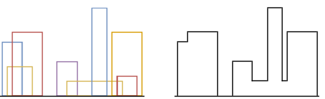
How can I create a silhouette like below picture?
How to create silhouette of a 3d city model using ArcGIS? Can the Skyline Analyst solve my problem?
Can you kindly give any advices?