I'm trying to configure an ArcGIS Field Maps inspection tool for electric/telephone pole inspections. The project takes place in ArcGIS Online, and the field workers plan to use field maps for iOS. I have primarily been working in Field Maps Designer.
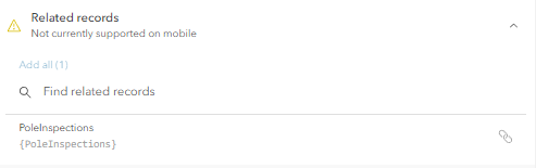
The issue is that I have a non-spatial table called `PoleInspections` stored in ArcGIS Online related to a feature layer of the pole features it inspects. Workers need to be able to create any number of inspection records in the non-spatial table that correspond to a given record in the poles feature class. However, the option to interact with related records from nonspatial tables is currently restricted for mobile field maps users:
I've tried creating a Field Maps form on the actual `PoleInspections` table but the Field Maps platform seems to only support forms for spatial data in the web map.
Is there a workaround that people have discovered for this use case?

