I have a problem with creating and drawing a polygon geometry that is located between the longitude margins (basically starts from East of Japan and ends in Alaska)
The way the API is drawing the polygon is basically in the reverse order.
I used the SketchViewModel to draw the desired polygon on a map (see print screen below), and I got the rings in long, lat coordinates as:
[
[
150.50951046729438,
83.60281202131557
],
[
-151.3277526400206,
83.90137770480938
],
[
-147.58991198755575,
-83.28282929241126
],
[
-151.7627425692197,
-84.13966376019715
],
[
177.9052071073019,
-83.43080587654312
],
[
154.09088177466649,
-83.43080587654312
],
[
137.0340923764776,
-80.80424221760879
],
[
146.74253029609173,
-33.83792786815416
],
[
150.50951046729438,
83.60281202131557
]
]
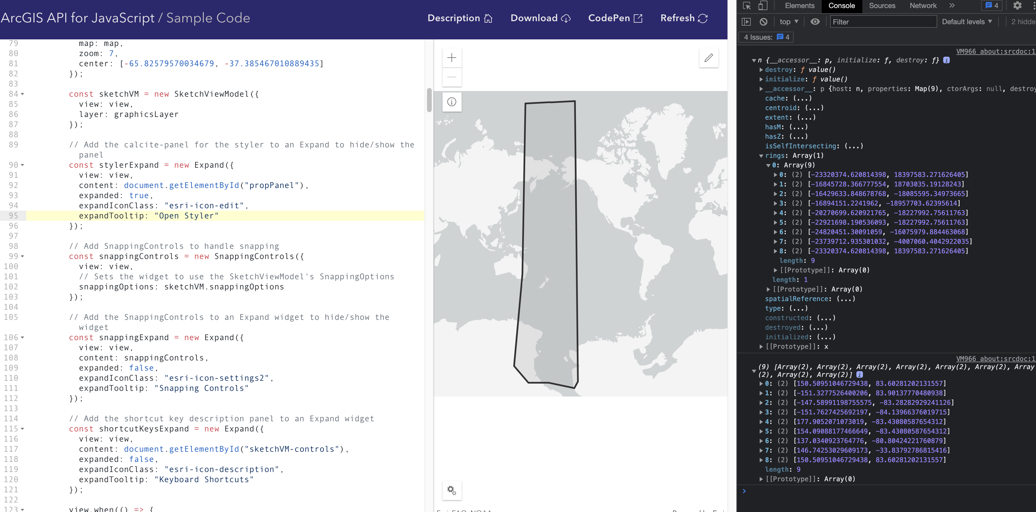
If then I use the same rings to create a polygon geometry, add it to a graphic layer and plot the layer in the map, the entire map is filled besides the original shape
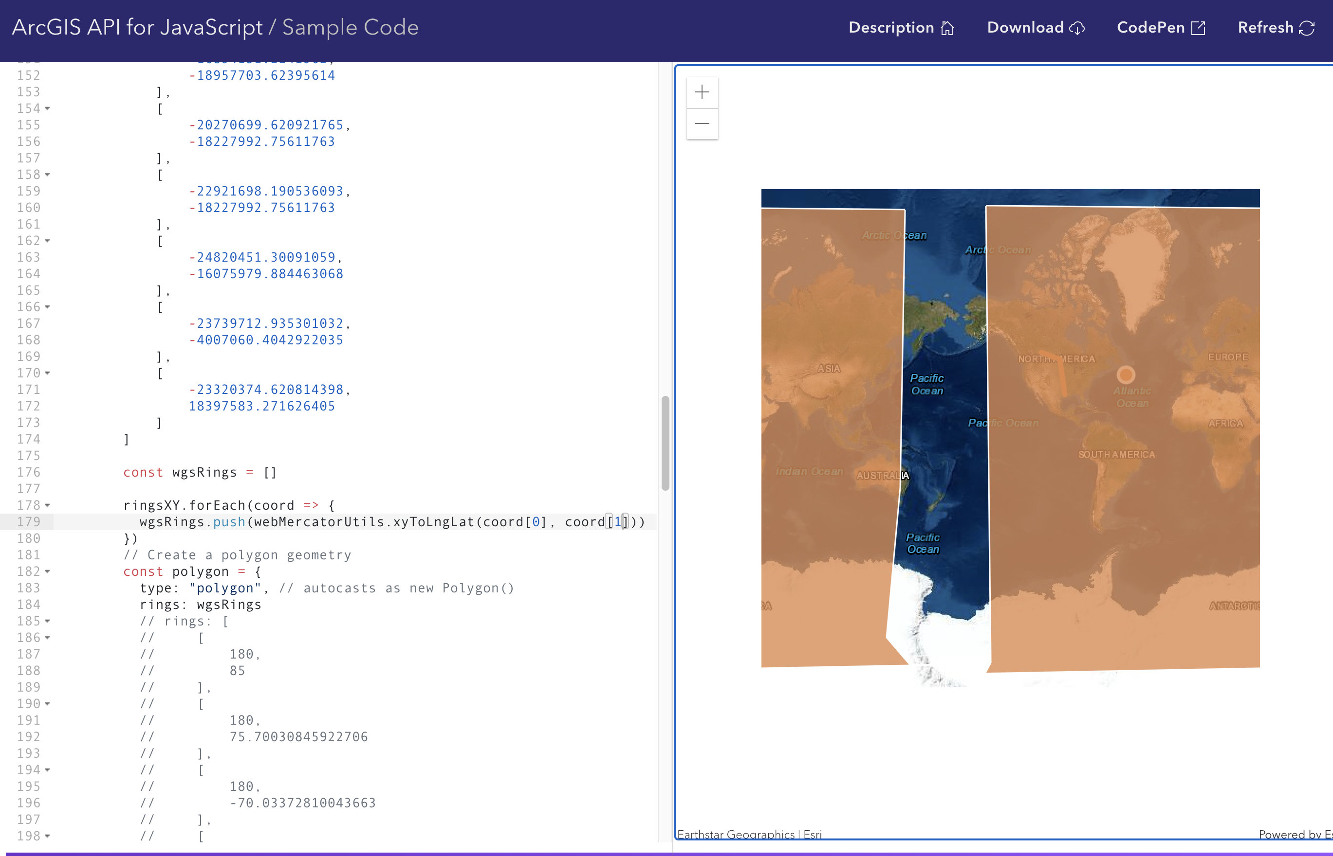
Isn't the API able to draw the polygon in between the longitudes margins (+180/-180) or is this a bug with the coordinates order?
Thanks!

