- Home
- :
- All Communities
- :
- Products
- :
- ArcGIS Online
- :
- ArcGIS Online Blog
- :
- The ArcGIS June Update Is Almost Here!
The ArcGIS June Update Is Almost Here!
- Subscribe to RSS Feed
- Mark as New
- Mark as Read
- Bookmark
- Subscribe
- Printer Friendly Page

The ArcGIS Online June update, includes improved item pages, mapping enhancements, ways to make it easier to manage your ArcGIS Online subscription, and more. For a complete list and more details on what’s new, see ArcGIS Online Help next week when the update is released. Also check out our blog posts, where we share some cool examples.
Improved Item Pages
Item pages have been redesigned with improved work flows, performance, and layout. They also include new functionality that help you explore and work with content. For content consumers, the pages provide more ways to explore items in-depth. For content creators and administrators, the new design makes it easier to modify item properties and configure settings.
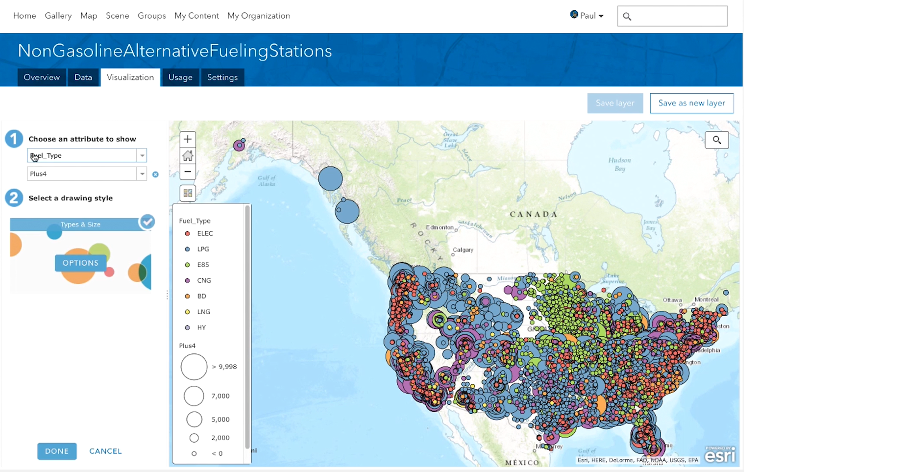
Content creators and consumers now have an improved experience for configuring feature layers styles, pop-ups, and other properties without having to leave the item page and go to the map viewer. Check out this video to get more details on how we improved the item page.
Map Viewer Enhancements
- You can now filter your data by the current date —for example, in the last week, or over the last two months.
- Use the new Continuous Timeline (Color) or Continuous Timeline (Size) smart mapping styles to view dates sequentially on a map. For example, use color to see how the rate of measles immunizations changed in the weeks before and after the launch of a pro-immunization campaign.
- We’ve made it easier to share pre-calculated, optimized routes with others to use in field apps such as Navigator for ArcGIS, and in web and desktop apps. Create your route in the map viewer, save the route layer as an item, and share it through the item page.
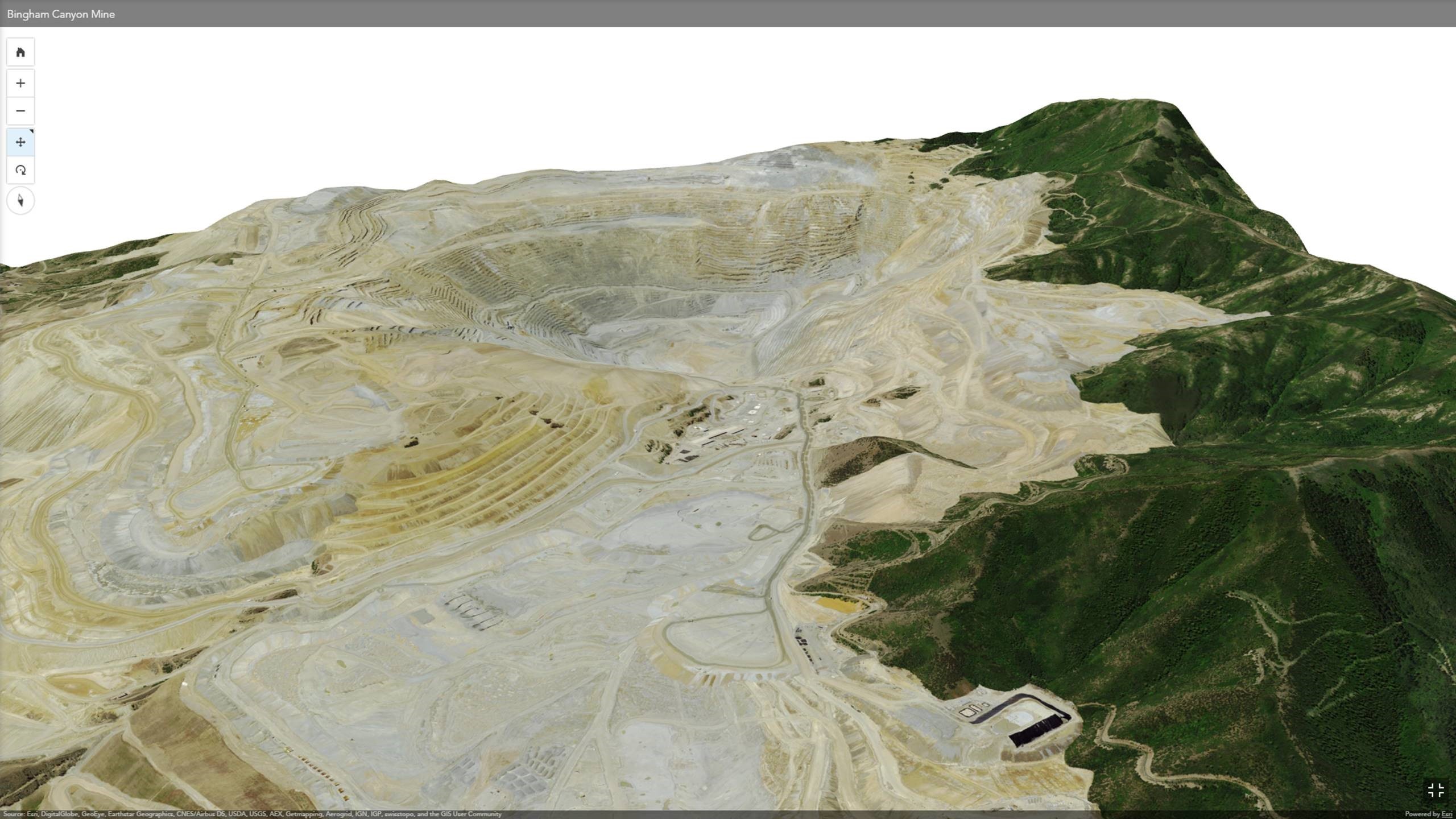
Scene Viewer Enhancements
- You can now use tile layers that have a Geographic Coordinate System (GCS) WGS84 projection in global scenes. If you have WGS84 basemaps in your basemap gallery, they can now be used in global scenes along with other WGS84 tile layers.
- The scene viewer will soon support a new type of scene layer called integrated mesh which you can create and share to ArcGIS Online using Drone2Map for ArcGIS.
- You can configure ground properties and elevation layers using the new Ground setting.
- You can enable a realistic atmosphere in your scenes by using the new High-quality setting.
- It's easier to adjust the environment to change how sunlight and shadows affect your scene. The environment settings also has new option to automatically play through the sun position for a given day or for an entire year.
Administering ArcGIS Online
- We’ve added more options for managing service credit budgets. In addition to managing credit budgets for specific members, ArcGIS Online administrators can now set a default credit allocation for new members. You can also do this as part of the invitation process for automatic and pre-established accounts.
- Enterprise logins can now be enabled for Esri access. This gives members access to Esri web resources for support, training, forums, downloads, and so on.
- If your organization restricts members to sharing only within your organization, administrators can now make a member's profile visible to everyone (public) so the member can be invited to groups outside the organization.
ArcGIS Content Updates
- Beta versions of Esri vector basemaps have been data updates for several areas, additional layers, and have addressed several known limitations.
- World Street Map, World Topographic Map, Light Gray Canvas, Dark Gray Canvas, and Reference layers have been updated with more recent data for North America.
- World Street Map has been updated to include detailed data for China with English labels, referencing authoritative map services built and maintained by the National Geomatics Center of China. Similar maps with Chinese labels are available to users in China and elsewhere.
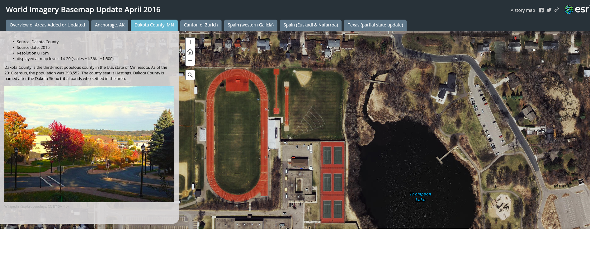
- World Imagery has been updated to include National Agriculture Imagery Program (NAIP) 2015 1m imagery for 22 additional states in the continental United States, which is visible at large scales (Levels 14-17), as well as other community contributed imagery.
- A new Imagery map in Geographic Coordinate System (GCS) WGS84 projection is available. The imagery map includes the same imagery as the standard World Imagery map in Web Mercator, with added coverage in the polar regions. The new imagery map supports 3D display in apps such as ArcGIS Earth as well 2D display for apps that use the GCS coordinate system.
- The National Agriculture Imagery Program (NAIP) image services, which include multi-spectral and multi-temporal imagery for the continental United States, have been updated to include NAIP 2015 imagery for 22 additional states. The NAIP image services now include NAIP 2010-2015 imagery, with 2-3 vintages of imagery for each state for comparison purposes.
- The demographic maps for the United States have been updated with the latest 2016 estimates and 2021 forecast data.
For all the updates and the latest information, go to the ArcGIS Online blog.
Web AppBuilder for ArcGIS Updates
- Add Color Picker theme allows you to choose your own color or match your agency's approved color palette.
- Select widget enables other widgets to take an action on the selected features.
- Share widget enables a social sharing experience of apps.
- Add Data widget enables you to search for layers in the organization, the web, ArcGIS Online, and a GIS Server and add them to the map at runtime.
- Enhanced Query widget adds spatial relationships such as intersect, overlap, and contain so you can perform the query against features in another layer. The result can be exported as a CSV, GeoJSON, or feature collection.
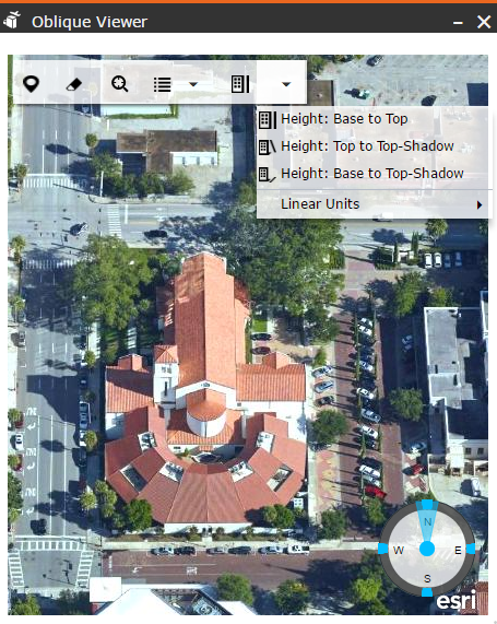
- Oblique Viewer widget displays images in their native coordinate system using the image's coordinate system. This allows you to pan in the oblique mode, in a single viewing angle, or switch angles to view an area of interest from different angles.
For more information, see the Web AppBuilder for ArcGIS help.
ArcGIS Maps for Adobe Creative Cloud Beta
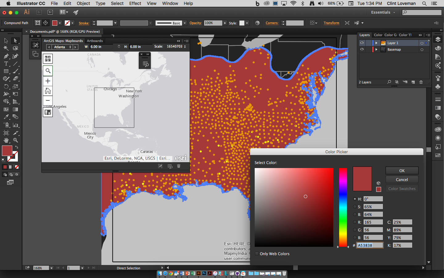
With this new app, you can design maps with the aesthetic you want.
- Access thousands of data-driven maps inside Adobe’s design apps.
- Download street, political, and physical features, man-made and natural event layers, satellite images, and many more maps, directly into Adobe Illustrator or Photoshop as editable vector layer or high-resolution images.
- Collaborate with the GIS department on map assets, saving valuable time usually spent going back and forth.
- Make maps that standout with your branding and update with the latest information.
ArcGIS Maps for Adobe Creative Cloud will be included with your ArcGIS Online subscription and will release in beta at the end of June. Sign-up to be notified about the beta and final release here.
Who Else Needs ArcGIS Online News?
Help keep other people in your organization updated on ArcGIS Online news. Simply share this email. Better yet, share this link so they can subscribe. That way, more people in your organization will get more benefits from ArcGIS Online!
You must be a registered user to add a comment. If you've already registered, sign in. Otherwise, register and sign in.