- Home
- :
- All Communities
- :
- Industries
- :
- Water Resources
- :
- Water Resources Questions
- :
- Re: Catchment vs watershed
- Subscribe to RSS Feed
- Mark Topic as New
- Mark Topic as Read
- Float this Topic for Current User
- Bookmark
- Subscribe
- Mute
- Printer Friendly Page
Catchment vs watershed
- Mark as New
- Bookmark
- Subscribe
- Mute
- Subscribe to RSS Feed
- Permalink
Wouldn't a watershed be the sum of the local and upstream catchments for a given point, while a subwatershed would be the local catchment?
Cheers
Malcolm
- Mark as New
- Bookmark
- Subscribe
- Mute
- Subscribe to RSS Feed
- Permalink
I think in general they are synonymous. Watershed, catchment, basin... these terms all mean the same thing, really (to me). They are confusing because these words or parts of them are sometimes used for other drainage related things: catchbasin, detention basin, watershed (as the ridge line or watershed divide), etc. ... I'm sure I'm missing others and some people may disagree with my definition of these terms since their "culture" used them differently than mine.
In Arc Hydro, "Catchment" is the default name used for the the "watershed" polygons that correspond to the stream link (strlnk) grid. These do not overlap each other.
In Arc Hydro, "AdjointCatchment" is the default name used for the the "watershed" polygons that correspond to the stream link (strlnk) grid. These overlap each other. They are used as part of the geo-network to make delineation of the watersheds very fast, the whole reason behind the DrainagePoint, DrainageLine, AdjointCatchments layers and HydroIDs, NextDownIDs, DrainageIDs in the first place.
In Arc Hydro, "Watershed" is the default name used for the the "watershed" polygons that correspond to the BatchPoint points. These overlap each other. That is, the Watershed polygons include all areas that drain to the point per the flow direction grid.
In Arc Hydro "Subwatershed" is the default name used for the the "watershed" polygons that correspond to the BatchPoint points. These do not overlap each other. That is, the Subwatershed polygons include only the areas that drain to the BatchPoint per the flow direction grid below any upstream batch points.
If you don't like the default names, you can always change them. I used to until I got tired of doing that. Eventually, I just embraced them.
Of course, this is just my understanding. You may find better information elsewhere.
- Mark as New
- Bookmark
- Subscribe
- Mute
- Subscribe to RSS Feed
- Permalink
I guess the take home point is that Arc Hydro 'catchments' are watersheds defined purely by physical properties (ie stream segmentation), while 'watersheds' are defined as the upstream catchment area for a particular point of interest. Would that be on the money?
For my current work, I need to delineate watersheds and subwatersheds for a fairly broad area. It's an arbitrary delineation based on the physical topography of the region, not to generate the watershed for a particular point or points of interest. So I think that I can get all I need from the 'Catchment' polygons (my subwatersheds), and then setting BatchPoints directly over major coastal DrainagePoints to delineate watersheds that group all the upstream catchments (my watersheds).
Does that make sense? Or would I perhaps be better off using 'Catchment' polygons for subwatersheds then calculating the larger grouped watersheds based on the HydroID and NextDownID?
Cheers
Malcolm
- Mark as New
- Bookmark
- Subscribe
- Mute
- Subscribe to RSS Feed
- Permalink
Hi Malcolm,
I am wondering what your final solution was. Did you end up doing what you've outlined in the above comment? I have the exact same assignment and was also stuck on the functional difference between catchments and watersheds. It appears that adjointcatchments are the largest drainage basins in my study area, thereby acting as the largest possible watersheds, and the catchments within the adjointcatchments would be subwatersheds. This is my first time using archydro though so any guidance is much appreciated.
Thanks!
- Mark as New
- Bookmark
- Subscribe
- Mute
- Subscribe to RSS Feed
- Permalink
Esther,
Welcome to Arc Hydro!
Catchments are Arc Hydro's basic watershed delineation of the agreedem based on the strlnk raster. A Catchment polygon is created for each confluence of the DrainageLines (or for each DrainagePoint). The number or density of the DrainageLines is based on the number of cells you chose in the stream definition step. The fewer the number of cells, the more "dense" the DrainageLine features (these come from the strlnk raster) and smaller the Catchment polygons.
After the Catchments are created, the AdjointCatchments are created. Each successive AdjointCatchment polygon consists of the next downstream Catchment. So the AdjointCatchment polygons overlap where as the Catchment polygons do not.
The purpose of the AdjointCatchment polygons is to make delineation of the watersheds and subwatersheds fast; very fast compared to delineating them without the adjoint catchments. Basically, the AdjointCatchment polygons are "pre-delineated" watersheds that make future delineations relatively quick compared to how the were originally done.
The DrainagePoints, DrainageLines, Catchments and AdjointCatchment (I think that's all) are part of a geodatabase network that Arc Hydro builds. If you study the DrainID and HydroID fields of the various vector feature classes you will see that there is a relationship there that associates them. These are used for the network. With this network, Arc Hydro can delineate a watershed quickly. When you process a watershed or subwatershed at point using Arc Hydro Watershed Processing tools, the area upstream of the point is "chosen" using the upstream AdjointCatchment polygon and then Arc Hydro only has to do the "tedious delineating" of the agreedem for a small part of the dem that is downstream of the AdjointCatchment polygon. This "tediously delineated" area and the AdjointCatchment area are combined to make a Watershed for the point that was processed.
As the story goes, when the Arc Hydro team demonstrated the use of a network in watershed delineation at a conference, the conferees thought it was a trick because it was so fast. Before that, the delineations took a laborious amount of time. At least that's what I heard from ESRI during training.
Of course, you can use the Catchment and AdjointCatchment polygons for other purposes.
Best,
Mark
- Mark as New
- Bookmark
- Subscribe
- Mute
- Subscribe to RSS Feed
- Permalink
Hi Mark,
Thank you, that all makes a lot of sense, understanding that AdjointCatchments are "pre-delineated" watersheds has cleared up a lot. I have a few more questions if you don't mind.
1. Is there anyway to automate the delineation of watersheds, without going in and setting individual points? And is this possible for sub-watershed delineation as well? I am working in an area that does not have gage stations, which is the example that is used for watershed delineation in most of the tutorials I have read.
Additionally, the subwatersheds are going to be used as the boundaries for local area environmental plans. It would be ideal if these could be of similar sizes to aid in the planning process. Since there is some flexibility in size of subwatershed, depending on where I place the point, some mechanism to outline the general size in an automation process would be great, although maybe I'm hoping for two much!
2. I am working in an area with a lot of coastline. I would like the watersheds to extend all the way to the coast to cover the entire study area. By experimenting I found that the smaller the threshold used when defining streams the more catchments that are generated, with many of them coming to the coast, leaving just a few gaps. Is there a better way to force delineation along a coastline or am I doing the correct thing?
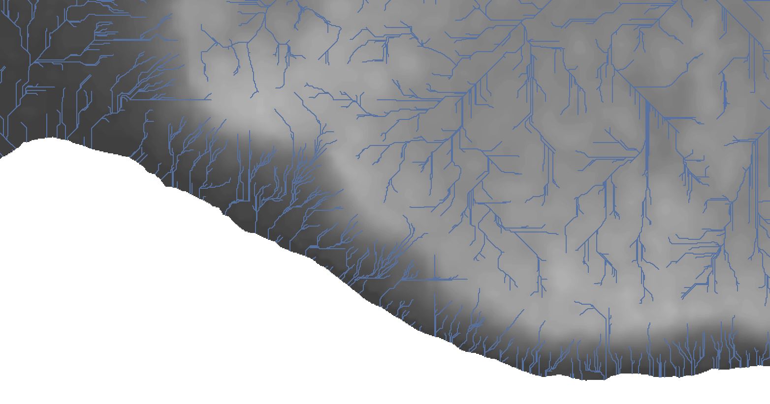
3. Since I have defined streams/drainage lines quite small in order to get them all the way to the coast you can see that there are many small streams flowing into the ocean (see image). Technically, each one of these is their own watershed if I were to delineate them. However this seems odd to me, do you know what is generally done in this situation? I hope that question makes sense.
Thank you!
- Mark as New
- Bookmark
- Subscribe
- Mute
- Subscribe to RSS Feed
- Permalink
Esther,
I don't work on the coast, at least not one as complicated as yours. I'm not sure of the best approach for "grouping" the coastal watersheds especially since you have several small ones.
1. Automated Point setting
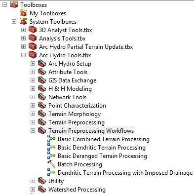
- The only "automation" I know of is the general Arc Hydro process. After that you have to set points. There are readymade Arc Hydro Model Builder Terrain Preprocessing Workflows that make performing and repeating Arc Hydro tasks easier.
2.&3. Capturing the small coastal watersheds: It is true that on the coast you could have one grid cell watersheds. One idea that comes to mind is to do this:
- Add elevations to your DEM in the area of the water. This could be flat or if you have bathymetry data that would work. You will likely have to use the Con() function or some other way to mosaic a separate constant elevation raster with your original rawdem.
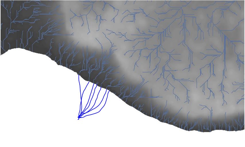
- Add to your agreestream layer polylines that connect the mouths of the small streams/creeks to and artificial point off the coast but in the extended DEM. You these could be straight (I've attached a screen capture with freehand lines. It seems to me that event if you didn't capture all of the "mouths", this would still work).
- When you burn the streams in and perform the flow direction step, I suspect the flow direction of the DEM grid cells on the coast will head toward the edge and be "caught" in the burned stream.
- Run the Arc Hydro process. I suspect you will end up with catchments that include all of the coast line. You will then need to trim them at the original coast.
Best,
Mark
- Mark as New
- Bookmark
- Subscribe
- Mute
- Subscribe to RSS Feed
- Permalink
Hi Mark,
I've been wondering if I should have an elevation for offshore or not, that is good advice, I will give it a shot and see how it goes.
What is your advice for dealing with a stream network that is interrupted by small ponds and lakes? Should I edit the stream layer to bisect the water body and delete the lines which make up the edges of these water bodies? (See image below). Or should I create polygons for the water bodies, delete the lines that go around the edges, and Level the DEM to lower the elevation of the water bodies? (and if I do Level DEM, should Fill Sinks be performed before or after?)
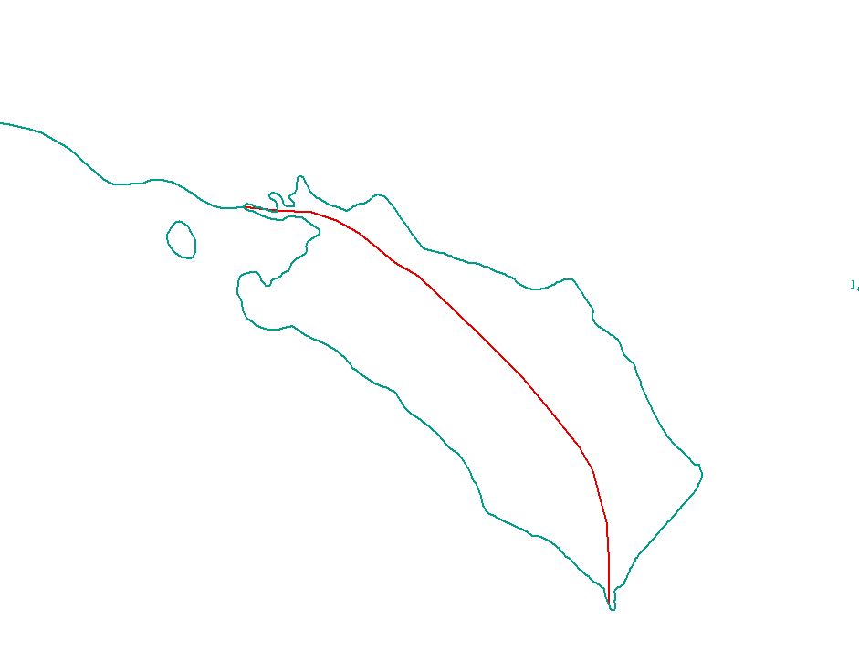
The green shows the original stream network with lines outlining the water body. Red shows an edited stream network which goes through the water body, deleting the coastline.
Also, the only available DEM appears to have some errors that were created when the tiles were added together, resulting in some striations that run throughout in a gridded pattern. Some areas are worse than others and it seems to not have a huge effect on the large watersheds but does affect the subwatershed scale. Have you ever come across this or have any ideas of how to deal with it? I read in one tutorial that perhaps setting the resampling technique to Cubic would help alleviate, but it hasn't worked in this case.
Any help is much appreciated!
- Mark as New
- Bookmark
- Subscribe
- Mute
- Subscribe to RSS Feed
- Permalink
Esther,
STREAMS
For watershed delineation, I would separate out the lake and pond outlines to another layer. You don't want the water outlines to act like streams.
I would draw a stream through the lakes/ponds that will "burn" a stream through the dams of reservoirs. IF you need a data point a the dam, Arc Hydro can get you one later with a batchpoint on the stream at the dam.
Sometimes the lakes have no data or Null in the water area. if so, I would use the CON() function to give them a value.
I would then run the Arc Hydro process to burn streams and fill sinks. This will not fill the ponds that have agreestream polygons through them. Ponds that are important to the flow path related calculations that do not have streams burned through them should be checked to see if the flow direction through them makes sense. If the flow path through them needs to be corrected, you can draw an agreestream polyline through them. This polyline does not need to connect to other agreestream polylines downstream. The fill sinks process will simply bring the dem cells up to and elevation that will work.
DEM ERRORS
I've heard of the gridded pattern issue and experienced it one time when I had to expand the DEM I have with a neighboring county's larger sized grid DEM. I don't recall that it caused any problems. I've seen threads relating to the issue, but haven't had much experience with it, so I'm not sure I can give you solid advice.
I searched and found these threads using the search words: DEM "grid pattern". (/search.jspa?q=DEM+%22grid+pattern%22 )
Unable to produce usable contours & hillshade from GeoBase 1:50K dem
Artifacts when changing to UTM
You might be able to find others.
Best,
Mark