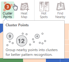
I really like the clustering symbology that's built into ArcGIS online and ArcGIS Maps for Office where at different zoom levels the points are aggregated together at a certain pixel tolerance.
Is there any way to do this in ArcGIS Desktop or ArcGIS Pro? Seems like the data for each zoom level would have to be created statically, but if I could create a modelbuilder to produce the results for the standard zoom levels it would be a handy thing to have around to improve visualization of certain datasets.