Running ArcGIS Pro 3.0.3
Hello! I'm currently working on my first GIS project where I want to analyze the relationship between built density, population density, and a series of economic indicators on a national level. In trying to format the data I've been clipping global data rasters using polygons from another data set. On a country by country basis this is no problem since I can just select by by attribute and then crop the raster.
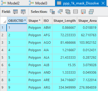
Table for national boundaries:
Sample output:
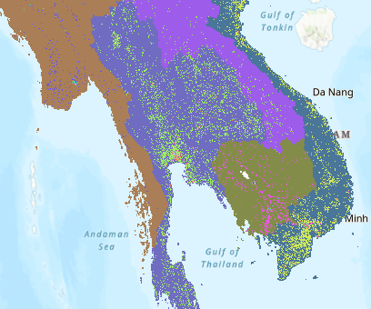
This works fine on a country by country level but becomes unsustainable when considering all the countries in the world, and then all those countries through time. So then I tried to create a model in order to automate this task. Initially I tried to replicate this task on a small scale using select and manually imputing the ISO code e.g. ISO = AFG
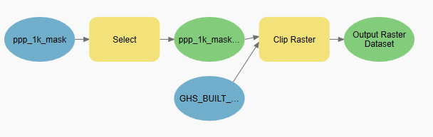
This seem to work well enough so I then attempted to scale up by iterating through all the features:
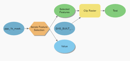
This model though ran in just a few seconds and didn't output anything.
Here are the logs:
Executing (Clip Raster): Clip "Build Layer 2022\GHS_BUILT_V_2020_Normalized" "-7374014.36551057 -6393314.96175094 7505723.76745417 6930686.77697801" C***test.gdb\Test I_ppp_1k_mask_Di_ExportFeature2_OBJECTID 0 ClippingGeometry NO_MAINTAIN_EXTENT
Start Time: Sunday, March 5, 2023 12:26:26 PM
Building Pyramids...
Succeeded at Sunday, March 5, 2023 12:26:28 PM (Elapsed Time: 1.74 seconds)
Now though I am a little unsure on how to move forward with my project. Am I doing something wrong with the 2nd model making it output nothing? Am I taking the wrong approach in splitting the raster? Any thoughts and assistance would be greatly appreciated!
Additional Info!
The data I'm using for the polygons comes from here: https://hub.arcgis.com/datasets/WorldPop::national-boundaries-1km/about
and the population and build density data originates from: https://ghsl.jrc.ec.europa.eu/download.php




