Ever since they were created by my colleague Allen Carroll and his team, I have been an ardent supporter of story maps. I teach story map workshops regularly. I also give many presentations throughout the year, and in many of those, story maps are the means by which I give the presentations. For keynotes, I often use the story map briefing format. One example of a story map is my presentation Geography: Key to Resiliency and a Healthy Planet, which was the keynote address I gave at a conference of the Geography Teachers Association of Victoria Australia and
https://storymaps.arcgis.com/briefings/be13926bbd1540b4b3e2631d5086a0f6
this story map briefing that I gave to an audience of university faculty and students. It has been amazing and heartwarming to see how story maps have been adopted by the GIS community and non-GIS community alike. Allen told me that by late 2019, over 1 million story maps had been created; they communicate in just about every conceivable field from archaeology to zoology, and perhaps 4 million by 2026.
Those of you reading this education blog know that here we are focused on education, and in the education space, story maps are used in many ways. Instructors use them to teach content (such as ocean currents, biodiversity, population change, and much more), and to teach skills in working with GIS tools, spatial data, and the ArcGIS platform. They are also useful in teaching about issues such as data quality, copyright (can I use that image in my map?), crowdsourcing, and to foster skills in communication. Students use story maps to document and showcase their work, to their peers, to their instructors, and as a living online resource that they can also show prospective employers. Students in my online courses regularly create story maps and send me the URL so that I can assess their work. In my face-to-face courses, students use them as a resource as they give oral presentations to myself and their peers instead of a standard PowerPoint, Microsoft Sway, or Prezi. They thus serve as useful assessment instruments for instructors.
I teach workshops focused on story mapping, in a beginning or intermediate-advanced manner (and feel free to use and learn from the content of these aforementioned workshops that I have shared with everyone). In those workshops, I always say, "Make a story map of your CV or resume."
Why? (1) It shows your prospective employer that you know something about web GIS tools; (2) It helps you to "stand out in the crowd". There is nothing wrong with a traditional text-based resume or CV, certainly, and I recommend that you provide a link to your story map CV on your traditional text-based CV. In fact I still lead with my text-based CV. (3) It is an interesting and engaging way to tell your story; (4) It provides a method for you to share your interactive maps, services, and multimedia (videos, audio, photographs) in a way that traditional methods do not allow; (5) It is a great way of encouraging yourself to keep current in story maps tools. Each time you update your story map, try a tool you haven't tried before!
Since you know your own story best, it is an easy way to get started with story mapping, and it is something you can revisit quarterly or whenever you need to add to it; (6) It provides your colleagues and readers with encouragement that they could do this as well, thus spreading the geo-love. Indeed, as my colleague Bern Szukalski wrote in his essay "Things you didn't know you could do with story maps", CVs are listed along with newsletters, guides, tutorials, annual reports, promotions, engagements, and more as some of the things you can easily and powerfully do with story maps.
To learn more, see this recorded webinar from my Esri YPN colleagues:
For some inspiration, here are some of my favorite examples. Amanda Huber of Minnesota has probably received more attention than just about anyone about her story map, where she included examples of her own work and also sections on why GIS matters!
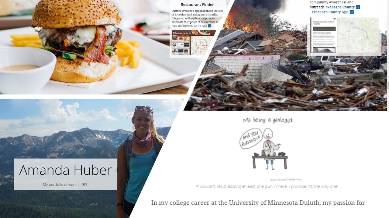
Part of Amanda Huber's story map.
Another compelling item to consider including in your story map is to use an Express Map to feature "stops" along your own journey. A 2019 Esri student volunteer, (Jessica) Jie-Shi Liew, used the express map in a wonderful way in the story map for her story.
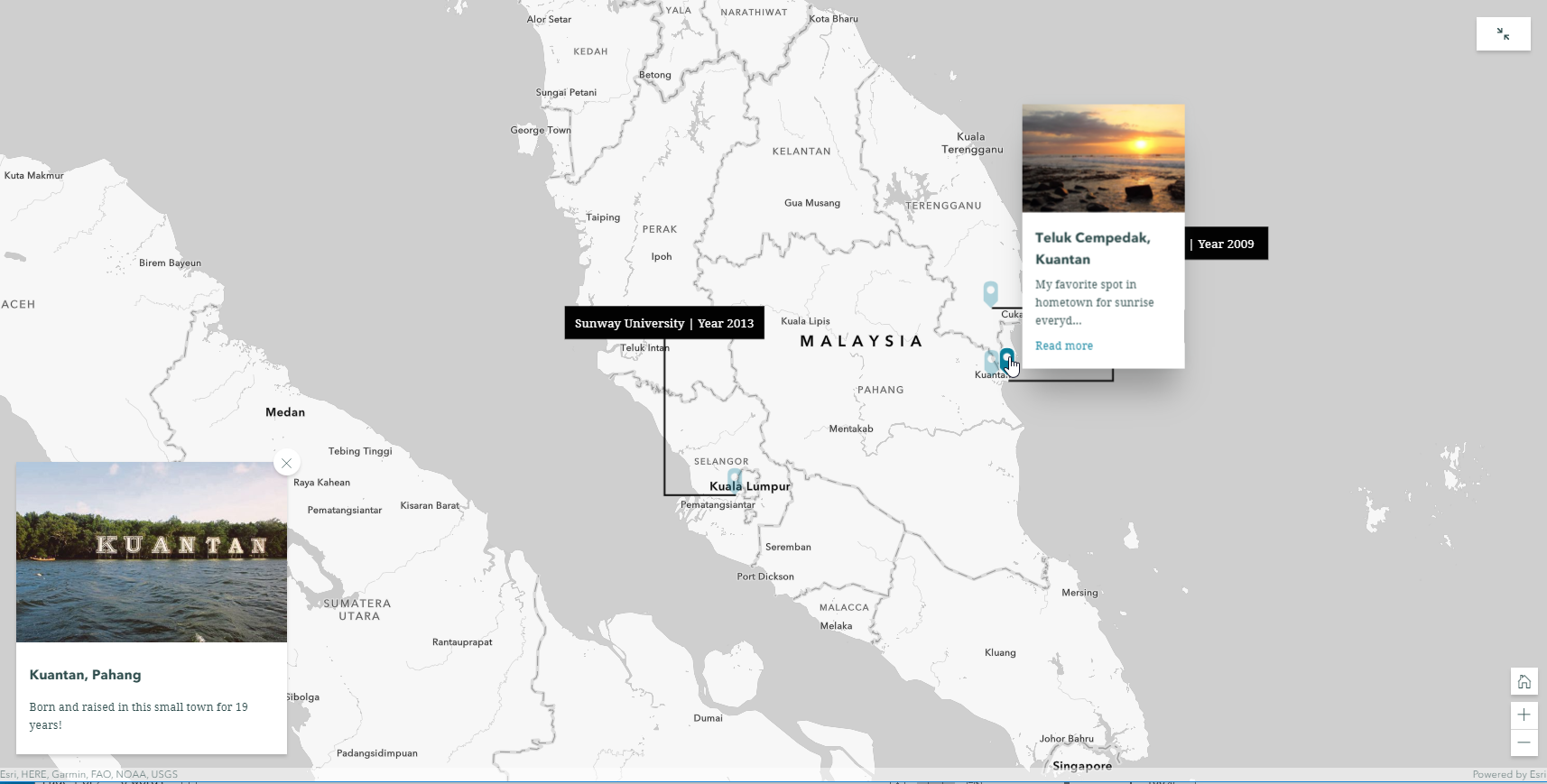
An effective use of the new express maps in this story.
Check out these other stellar examples, and feel free submit your own favorite examples in the comments section below!
Olivia Koch:
https://storymaps.arcgis.com/stories/64b637d6ada5425e84af55f996136097
includes a very impressive array of work in an easy to read format, with a fun picture in front of the GeoGeek sign at the Esri UC!
Ugochukwu Udonna Okonkwo:
https://storymaps.arcgis.com/stories/d4e0a8abb9b84f5ca410e624fd6de58e
includes code snippets and links to work in Geospatial Data Science, AI/ML, and IT!
Georgios-Nektarios Tselos:
https://storymaps.arcgis.com/stories/a469511fe82f4ee6a5900ca626594aa8
includes some very stunning 3D work, and more.
The example of a "GeoResume" from Renato Salvaleon profiles accomplishments and projects using a mix of media and maps, with GIS buttons to start things off in an eye-catching way!

Part of Renato Salvaleon's story map.
One of the best things about story maps and other web mapping applications from Esri is that they can be embedded in other types of multimedia, such as GitHub.
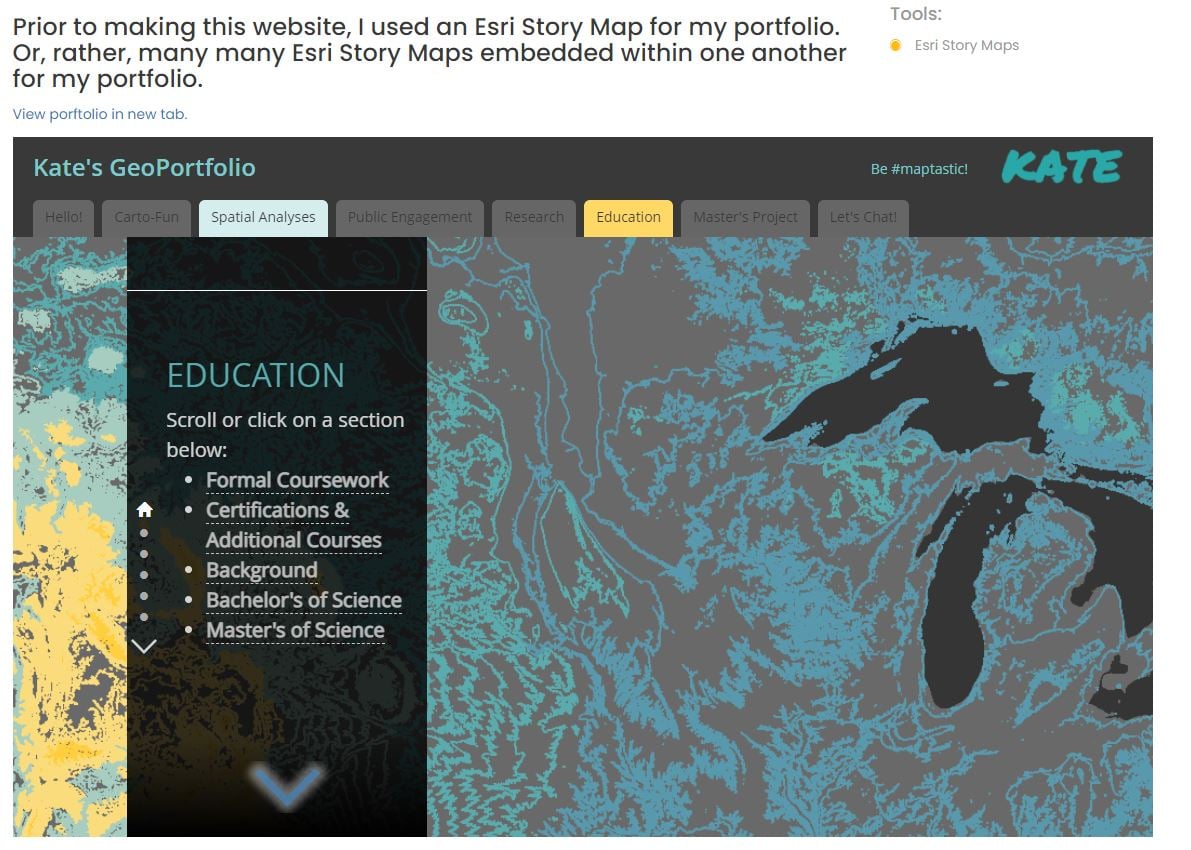
Part of Kate Berg's story map, which is embedded into Kate's web page.
I'm not telling you all to do something I am not doing myself: My own Joseph Kerski story map CV, is here. I had a blast doing it and had to tear myself away after a few hours. I have the story map, a video about me, and my text-based CV linked to my website. In the map I included some 2D and 3D web maps associated with curricular items that I created, selected story map presentations (so, yes, a story map embedded in a story map!), and some of my favorite geeky photographs of myself, and some of my favorite landscapes and human-built features, including the heaviest globe in the world, built in 1964 for the World's Fair, in New York City, below. More importantly, I can easily update my story map with new publications or other new segments of my journey are completed, and you can, too!
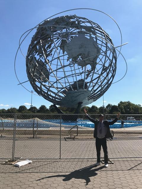
That is one big globe! It was created for the 1964 World's Fair.
My story map includes a web map with some of my accomplishments and where they occurred. This may have been the most enjoyable segment to create. While you can certainly make a story map that is entirely composed of text and images and videos, the value-added component of story maps is … maps! Thus I highly encourage you to include at least one interactive web map showing where you studied, traveled, had that internship and job, and so on.
What will I do with my CV story map next? My next task is to create a section that includes some of the people I have been most privileged to collaborate with. That will be fun and a kind way to acknowledge those who helped me along the way.

Part of my own storymap CV--Joseph Kerski.
Explore but don't feel confined to these examples: Be creative and do your own thing!