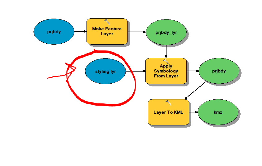
Basically I'm getting a WFS from out portal to export as a kmz in a widget in WAB. I've done this successfully, however I want to add symbology to it. It's pretty much useless without the symbology in it. My question is how do I get the styling layer to Arc Server? How do I run this GP tool successfully on my local computer and then publish it to Arc Server. I want the user to export a wfs layer to a kmz styled with WAB geoprocessing widget. Could someone help please? I've seen this question posted before with no replies.
Thanks!