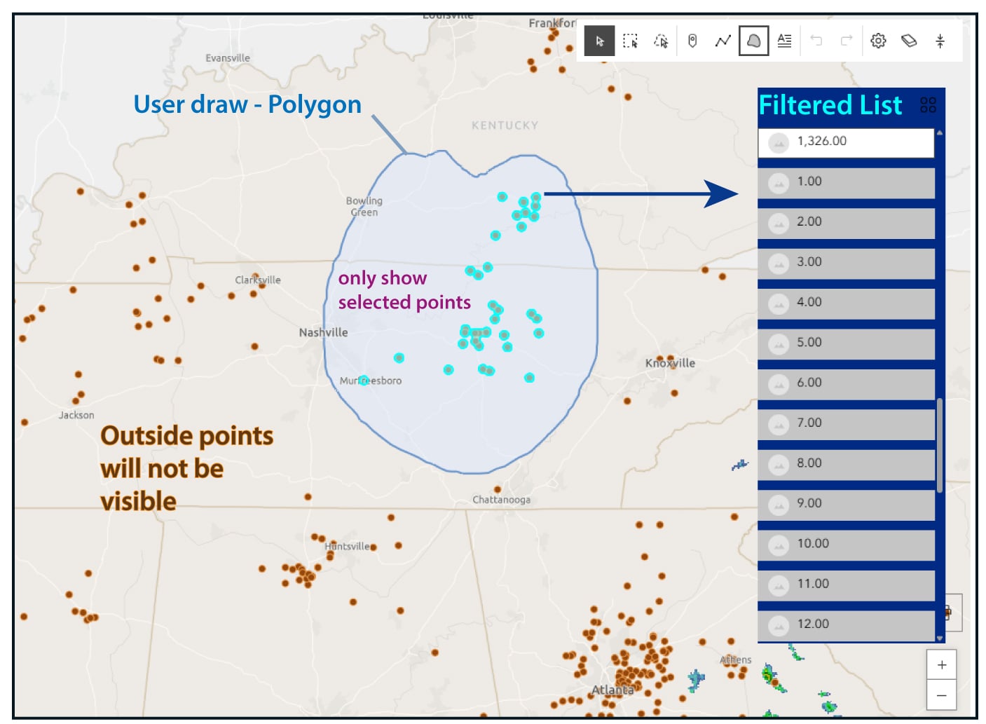
Hello everyone, I'm looking for an ArcGIS Online tool that allows users to draw a custom polygon on the map and perform a spatial query—specifically, to return features from a point layer that intersect with the drawn geometry. Ideally, I’m looking for a solution where users can draw directly on the map, and both the map view and a list widget automatically update to show only the points within or intersecting that geometry. The goal is to display the drawn polygon on the map, highlight only the relevant points, and show a filtered list of the corresponding records (See attached image). I’ve explored the Draw and Query widgets in Experience Builder and Dashboards but haven’t found a widget that supports this type of spatial filtering based on user-drawn input. Does anyone know if this functionality is currently available in any ArcGIS Online apps? I’d really appreciate any guidance or suggestions on how to implement this workflow. Thanks!
JB