The end goal is to update an ongoing shapefile with missing well data. As field agents find missing wells, they can update a spreadsheet with GPS coords (Decimal Degrees). Once a month or so I can run the Python code in ArcMAP and update the shapefile with new points. I am trying to insert the GPS coordinates as points into a shapefile in ArcMAP 10.7 using Python 2.7.
Everything appears to be working correctly, the data table and attributes are correct, the newly added points appear to be correct relative to one another. The issue is when I try to update an existing file. The newly added points are way off somewhere else. In the example here, I tried to add the exact same GPS coords (in decimal degrees) as an existing point. You can see the first entry, the Y_Coord and X_Coord for Well_1 is the same as 1. However the new point is way below the other points.
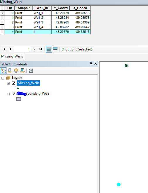
Immediately, I am thinking this is a coordinate issue of some sort, and searches on the problem indicate a coordinate issue as well but I have a million-times checked to make sure the shapefile, a boundary layer (visual check only), and dataframe are all in the correct geographic and projection coordinate systems. GCS being used is GCS_WGS_1984 (WKID: 4326) and PCS is WGS_1984_UTM_Zone_16N (WKID: 32616).
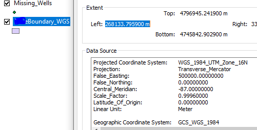
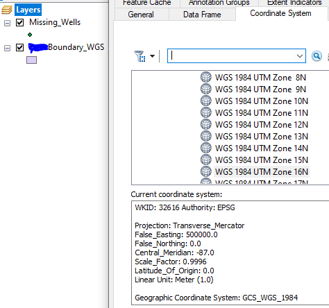
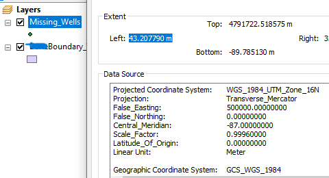
I have double-checked, triple, a million times checked to make sure the coordinates systems are correct. I have tried to specifically assign it in Python (although I am not sure I am calling it correctly.
Questions:
Am I defining the spatial reference in Python correctly? I feel like I am just calling the object but not actually initiating it.
If not, is there a way to specifically tell Python to apply this in the correct GCS/PCS?
import arcpy

#one coordinate only for testing
coords = [(1, (43.20779, -89.78513))]

# link to shapefile
shapefile = r'M:\ARC\gis_users\Missing_Wells\Missing_Wells.shp'

# Define the spatial reference (GCS_WGS_1984 = 4326, PCS_WGS_1984_UTM16N = 32616)
arcpy.SpatialReference(32616)

#use SHAPE@XY syntax to add point features to a point feature class
with arcpy.da.InsertCursor(shapefile, ['Well_ID', 'Y_Coord', 'X_Coord', 'SHAPE@XY']) as cursor:
#Insert new rows that include the well ID and a x,y coordinate pair
     for Well_ID, (lat, lon) in coords:
          cursor.insertRow((Well_ID, lat, lon, (lat, lon)))
          print('added')
...

sys.exit()
p.s. yes, I know there are tools in ArcGIS Online that can accomplish this goal much easier and in a more timely manner. Our Org will be moving over to ArcGIS Pro next year. We just don't have the budget for it at the moment.


