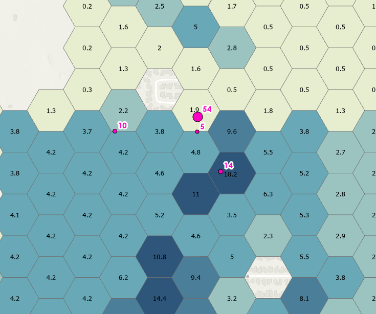
I have a polygon tessellation representing 5 acres, and is populated with an estimated value of children between the ages of 0-10. I have a point feature class that represents child care locations and it contains a capacity number. I want to somehow represent how many of the nearest polygons would be needed to fill the capacity of the point value. So if I have a point with a capacity of 50, I would want to know how many of the closest polygons that point would cover.