Scenario: I have a roads layer with attributes denoting different trucking categories. I already have a chunky model (or 3) which takes the primary road layer plus numerous overlaying trucking layers, spatially aligns them (snapping intersections, etc. as they're all independantly created and don't perfectly match despite being from the same custodian) and transfers attributes from the tracking layers to the main road layer.
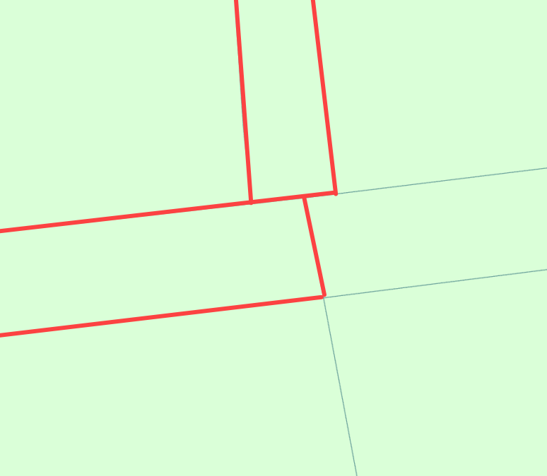
The image below shows an example of an intersection where the roads that accept trucks are highlighted red but don't meet.
Problem: I use these roads to build a custom network for distance and route generation via Network Analyst in ArcGIS Pro. The gaps in the road network (not my data and not designed for network connectivity - built around asset management) don't meet nicely at intersections (as shown) and I have to manually fix the segments to make connect as per the second screenshot.
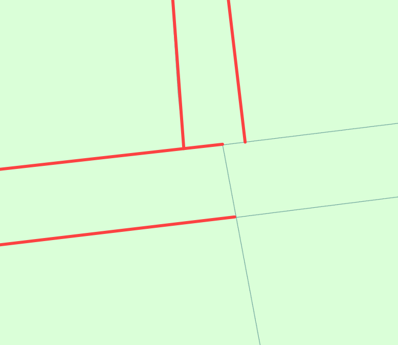
Question: Can anyone suggest a way (or series of steps) that could be implemented in Model Builder to fill the gaps between like segments, resulting in something like the below? I imagine there would need to be a tolerance built in, or maybe an identifying overlay polygon layer (which I already have for finding known issue spots).