Hi,
Drone2Map has the nice option to gather coordinates for control points directly in the software using the option control from map. The problem is, that Drone2Map automatically assigns a Vertical and Horizontal Accuracy of 2cm, which is quite unrealistic using Basemaps coordinates.
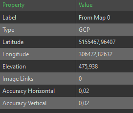
Because of this I want to change the Accuracy to more realistic values like for example 40cm horizontally and 20 cm vertically. Those realistic accuracies should lead to better Aerotiangulation results (which lead to better models). But changing those values seems not possible in the software itself!
The only way I found to do so was measuring the control points, saving the project and modifying the control.json file of the project.
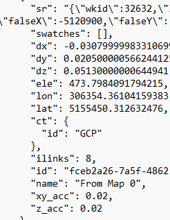
This procedure works but I imagine, that this is not the way I am supposed to work?!?
Can someone help me out and show me a more elegant way? Or is Drone2Map lacking this functionality at the moment?
Thanks in advance!
Best regards
Lars

