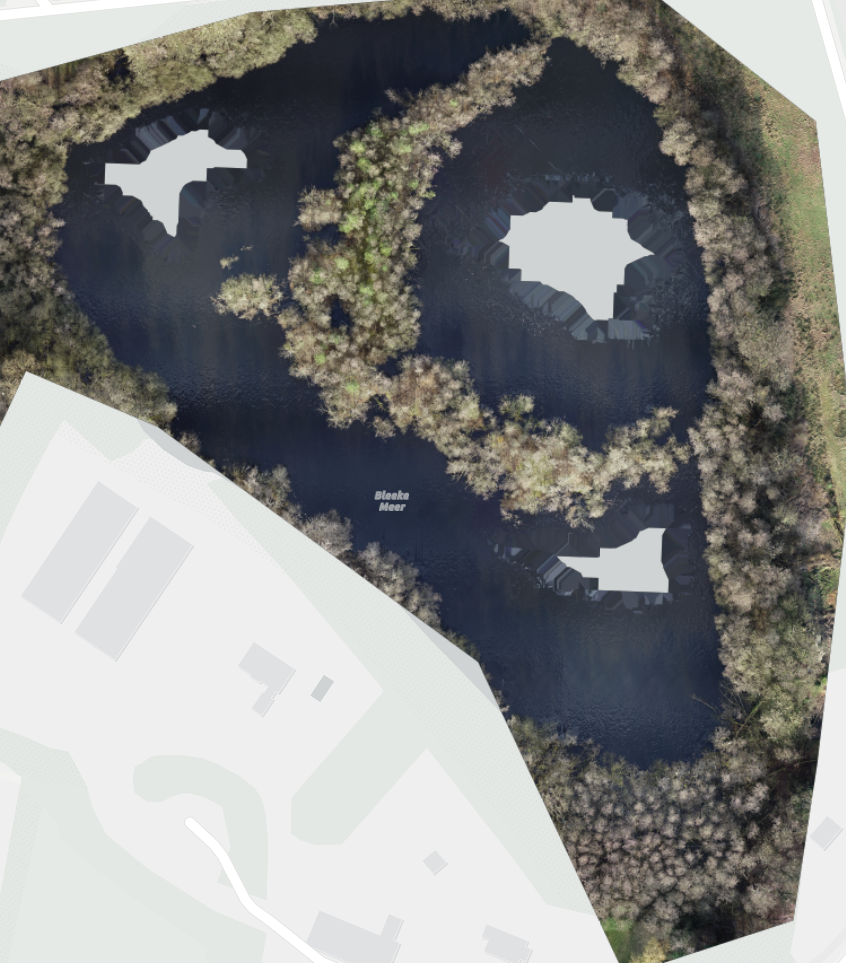
This morning I flew two of our lakes, after processing in sitescan they show 'holes' in the orthomosaic when a bit 'off shore'.
How would I be able to fix this?
Phantom4 RTK & Sitescan on an iPad & SDK controller
Thanks for you time.
Bert
Hi @Gisbert61, Photogrammetry works by identifying matching points between images to perform a triangulation. This can be challenging when working with reflective surfaces, moving features or monotonous/repetitive features; water is all of these things... One suggestion that could help for your example since your lakes are not very large is to fly higher so that all your images show some shoreline. In our desktop ArcGIS Reality software we have a "waterbody correction feature" functionality that helps with reconstruction over water, we're considering adding this capability to Site Scan as well. If it's of interest to you, it would be great if you could suggest it as an "Idea" so we can gauge interest in the capability from other users and prioritize it.
Regards,Nico
Signed in members can post, follow updates, and more. New here? Register a free account.
Find useful guides, FAQs, and documents to help you navigate and make the most of Esri Community.