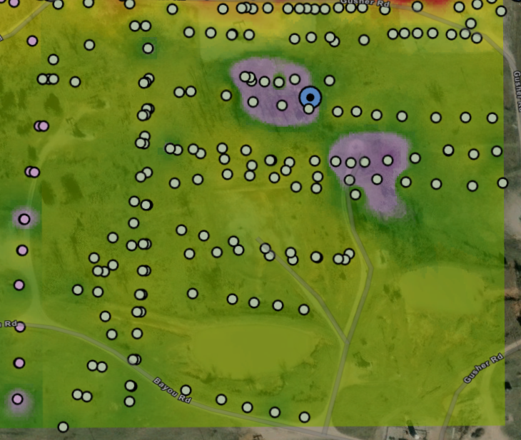
I have data points that are GPS cartesian coordinates with values that I analyze using IDW or kriging. Is there a way to remove the area where there is no data?
The software fills in the area with no data with colors that are projected out from nearby data so it is not accurate and I would like to remove it.
In the attached image, the bottom right has no data so it should only show the map below, with no color scheme.
In some cases I've created several squares and rectangles that touch each other but I don't like the way it looks.
Thanks in advance!